RoadHook Rides
Long rides across India: routes, permits, seasons, packing, budgets and the skills that get you home.
The blog of Yatri (Ride Atlas), part of RoadHook. Yatri means traveller. Written by Sapta.
80 posts9 kinds157 interactive charts and calculators61 forum questions answered
Start with these
Find a post
80 posts. Search, or pick a kind of post to see more.

Why a river and a highway bend the same wayA meandering river and a ghat road look nothing alike, yet both bend for one reason: each has a slope it is happy with, and when the ground is steeper than that, the only fix is a longer path.What ifs17 min read

What would a road trip on Mars look like? The real planA third of the gravity, a hundredth of the air, a 687-day year and dust storms that blot out the Sun. Here is the ride, planned like a real one.What ifs15 min read

What if you rode through a monsoon on Titan? The real numbersMethane rain the size of marbles, falling at walking pace, on a moon at −179 °C with air four times thicker than ours. Here is the ride, solved.What ifs17 min read

What if you rode non-stop until the bike or you gave up?The bike can run for 125 hours before its oil is due. You start making mistakes after 16. Here is the race, worked out hour by hour.What ifs11 min read

What if you rode around the whole Earth in a straight line?The longest straight line you can ride on land runs 11,241 km from Portugal to China. The other 72% of the circle is the problem.What ifs12 min read

What if you built a road straight up into space?A 100 km climb at the steepest gradient Indian hill roads allow is a 1,429 km ride. The rider gives up first, the petrol engine around 13 km up, and the tarmac needs a tower no material yet can carry.What ifs17 min read

What if there were a road to the top of Everest? SolvedA 74 km road at Indian hill-road gradients, an engine down to a third of its power, and a rider with three minutes of useful thought. Here is the working.What ifs17 min read

What if the monsoon never came one year? Roads, rivers, cropsIndia would lose 2,855 cubic kilometres of rain, three-quarters of its year's water. The worst real droughts tell us what that does.What ifs11 min read

What if roads healed themselves? The science of self-healing asphaltAsphalt already heals, just too slowly to beat a monsoon. Add steel wool and a magnet, or oil-filled spores, and the clock changes. Here is the maths.What ifs14 min read

What if India's highways were joined into one straight road?Lay all 1,46,572 km of national highways end to end and the road wraps the Earth 3.66 times. Build it truly straight instead, and it leaves the atmosphere before the end of a long day's ride.What ifs14 min read

What if India had no roads tomorrow? A rider's mathsDelete 63 lakh km of road overnight and the bike still moves. The physics says how fast, how far, and which bike wins.What ifs13 min read

What if GPS switched off worldwide for a week? A rider's guideThe map on your phone is the least of it. GPS is a clock first, and a week without it costs the UK alone £7.6 billion.What ifs12 min read

Zuluk to the plains: a 4,250 m drop in one riding dayAir pressure, temperature, forests and brakes all change faster on this descent than on almost any other road a rider can do between breakfast and dinner.Good reads16 min read

Zoji La history: the Srinagar-Leh road from 1948 to the tunnelTanks crossed it in 1948, snow shut it for half the year until about 2020, and on 9 June 2026 the tunnel beneath it broke through. A dated history of Ladakh's oldest road gate.History13 min read

Wind chill on a motorcycle: how cold 60 km/h really feelsA 5 °C morning at 60 km/h feels like about -2 °C on bare skin, and a 0 °C pass at the same speed like -9 °C. Here is the formula, a calculator and what layers can and cannot fix.Technical12 min read

Why the Northeast is India's next great motorcycle frontierNew tunnels, a ₹4,900 crore frontier highway and online permits are opening Sikkim and Arunachal to riders. The same mountains also produced the 2023 Teesta flood. A case for going, and for going carefully.Good reads12 min read
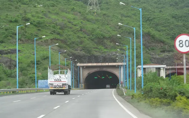
Why bikes are banned on Indian expressways, and should they be?The law already has a speed limit for motorcycles on expressways. So why can't a 400 cc touring bike use one? The legal trail, the safety case and a fairer rule.Good reads14 min read

What if you stacked every speed breaker in India?Nobody counts India's speed breakers, so we estimate them, pile them up and ride over them. The tower clears the edge of space, for about a second.What ifs16 min read

What if you run out of fuel on Manali–Leh? The 325 km gapBetween the Keylong pump and Karu there is no official petrol for about 325 km, with three passes above 4,800 m. Run dry in the middle and you are not just stuck: you are stuck at altitude.What ifs13 min read

What if you ride without a helmet for one trip? The physicsOne trip is all a crash needs. Here is what happens to a bare head hitting the road at 27 km/h, the speed helmet standards are built around, and what the crash studies say a helmet changes.What ifs14 min read
What if you ride to 5,000 m in one day from sea level?Fly into Leh at breakfast, ride Khardung La after lunch: it is possible, and it is exactly the ascent profile altitude doctors call high risk. Here is what the thin air does, hour by hour.What ifs14 min read

What if you ride all day without food? Blood sugar and crashesA healthy body will keep your blood sugar up through a foodless 10-hour ride. What it will not protect is your hydration, your evening alertness, or a diabetic rider's brain.What ifs15 min read

What if you ride 24 hours without sleep? Microsleeps and alcoholAfter 17 to 19 hours awake, reactions look like those of someone at a 0.05% blood alcohol level. By 24 hours you are riding worse than most drink-drive limits allow, and you will not notice the lapses.What ifs13 min read

What if you hold your bladder on a 10-hour ride? The body's viewYour bladder will not burst on the highway. What a held bladder does is quieter: it pulls your attention, tempts you to stop drinking, and makes a crash worse.What ifs14 min read

What if you dug a tunnel straight through the Earth and rode in?Drop a motorcycle into a hole through the planet and gravity does the riding: 42 minutes to the far side, any city to any city. Then the air, the heat and the rock get their say.What ifs18 min read

What if the whole monsoon fell in one hour? The mathsIndia's 2026 monsoon dropped 759.4 mm of rain over four months. Squeeze it into sixty minutes and you get 2,496 cubic kilometres of water, a sky you can't see through, and air heated by about 190 °C.What ifs15 min read

What if the Earth stopped spinning while you were on the highway?On NH16 near Bengaluru you are already doing about 1,630 km/h east, along with the road, the air and everything else. Stop the planet and only you keep going.What ifs13 min read

What if the Bengaluru–Kolkata road sloped downhill all the way?Switch the engine off in Bengaluru and coast about 2,000 km to Kolkata. The slope you would need is gentle; the height you would have to start from is not.What ifs17 min read

What if it snows overnight on a pass you're camped on?You pitched the tent at 4,500 m under a clear sky. At 2 a.m. the fly starts sagging. Here is what the snow, the cold, the stove and the bike will do by morning, and what to do about each.What ifs13 min read
What if gravity doubled halfway through your ride?At the 1,000 km mark on NH16 the planet's pull jumps to 2 g. Your bike's mass stays the same; its weight doesn't. Here is what happens to tyres, springs, brakes, fuel and your spine.What ifs16 min read

Wettest places in India by annual rainfall: a rider's listMawsynram gets about 340 times the rain of Leh. Here is what the wettest belts of India do to a road, a tyre and a rider.Top lists11 min read

Western disturbance snowfall forecast: reading pass closuresMost surprise closures on Zoji La, Baralacha La and Rohtang come from one weather system with a predictable speed and lifespan. Learn to read it.Advanced13 min read

Water crossing motorcycle technique: nallahs, slush and black iceGlacial streams peak in the afternoon and ice grips about a tenth as well as wet tarmac. Time, read and ride high-pass surfaces by the numbers.Advanced13 min read

Tunnels are rewriting Himalayan road trips. Is that bad?Atal, Sela, Z-Morh, and soon Zojila and Shinku La: the passes riders fought for are going underground. What we gain, what we lose, and the numbers behind each tunnel.Good reads13 min read

Ted Simon's Jupiter's Travels: the India chapter, 1970sTed Simon's own notebooks, now being published, put dates and rupees on his months in India in 1976–77: Madras, the Rameswaram ferry, the Konkan coast, Darjeeling and the road out through Amritsar.Stories14 min read

Tawang bike trip: Arunachal e-ILP, route and Sela tunnel guideThe permit, the 480 km climb from Guwahati, the tunnel that cut 90 minutes off the ride, and the Bum La rules that decide whether your own bike reaches the border.Guides14 min read

Spiti Valley bike trip: route, permits and season guideRide the Spiti circuit clockwise, Shimla to Kaza to Manali: the stages, the altitude ladder, the fuel gaps, the Kunzum window and the landslide stretches of Kinnaur.Guides12 min read

Solo bike trip safety in India: tracking, check-ins, night rulesSolo touring risk is not mainly about strangers. It is about crashes on highways, at dusk, far from help. Build a system that covers those.Advanced14 min read

Sikkim bike permits: Nathu La, Zuluk and North Sikkim guideWhich corners of Sikkim need a Protected Area Permit, where a rider gets one, what papers the bike needs, and the 2026 rule change that could keep out-of-state bikes off the high roads.Guides17 min read

Roads with the most hairpin bends in India, ranked by countKolli Hills has 70 numbered hairpins, Valparai 40, Kalhatty 36 and the Gata Loops 21. Here is the full count, what the road code says a hairpin should be, and how to ride one.Top lists13 min read

Riding a bike in heat: heat index, hydration and timing in IndiaFull riding gear at 35°C can push your core to moderate hyperthermia in under two hours. Here is the physiology, the IMD numbers and a schedule that works.Technical16 min read

Riding Solo to the Top of the World: Gaurav Jani's ChangthangIn the mid-2000s a Mumbai filmmaker loaded a Bullet with camera, tent and fuel, rode to Ladakh's Changthang plateau alone and filmed himself doing it. The film set a template for a generation of Indian riders.Stories13 min read

Planning a solo Northeast bike ride: a real question answeredSix states, four permit systems and the tail of the wettest monsoon in India. The order you ride them in decides whether the trip works.Questions answered13 min read

One Man Caravan: Robert Fulton's 1932 ride across IndiaAn American rode a Douglas twin through Rajputana, Kashmir, the Khyber and down the Grand Trunk Road in 1933. His own book shows what Indian roads were like 93 years ago.Stories14 min read
Old Silk Route in Sikkim: the Jelep La trade road's historyBefore Zuluk's loops were a bucket-list ride, they were the mule road from Kalimpong to Lhasa. Wool, an invasion, a fleeing Dalai Lama, a 44-year closure and a 2026 reopening.History12 min read

National highway length by state: India's road map, rankedMaharashtra has more national highway than any other state, but Nagaland and Sikkim have the densest network. The MoRTH numbers for all 28 states, by length, by area and by population.Top lists14 min read
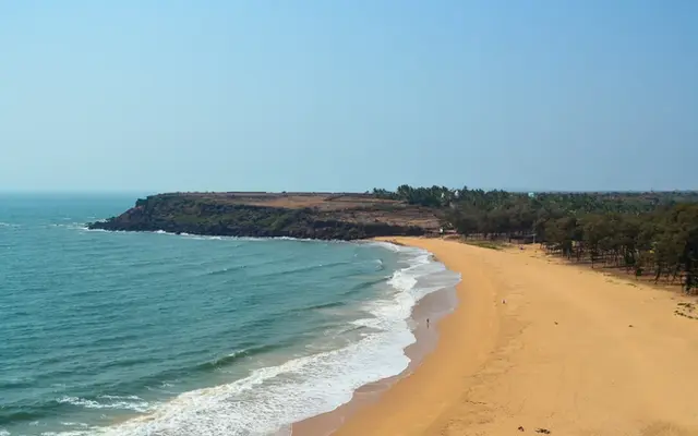
Mumbai to Goa bike ride: NH 66 or the Konkan coastal roadThe four-lane NH 66 is nearly done but not finished, the coastal road is slower and better, and the monsoon decides more than either. A 2026 route guide for riders.Guides14 min read

Monsoon onset date in India by region: a rider's calendarThe monsoon reaches Kerala on 1 June, Mumbai on 11 June, Gangtok on 8 June and Delhi on 27 June, and it leaves in reverse. Here are IMD's normal dates turned into a riding calendar.Technical12 min read

Mig La pass: is it the world's highest motorable road?At 19,400 ft (5,913 m) by BRO's count, a new road in eastern Ladakh claims the altitude record from Umling La, which Guinness still lists. Here is who built it, why, and what that height does to a rider and an engine.Stories16 min read

Manali-Leh highway history: from 1964 track to Atal TunnelA road started from both ends in 1964 became Ladakh's second lifeline in 1989, and a 9.02 km tunnel rewrote it in 2020. The dates, the passes and the annual race to open it.History13 min read
Longest road tunnels in India, ranked by length (2026)Chenani-Nashri still holds the title by 260 m, the Mumbai-Pune Missing Link just slipped into third, and Zojila will beat them all in 2028.Top lists13 min read

Longest river bridges in India you can ride, ranked by lengthThe ten longest road bridges over Indian rivers that a motorcycle may cross, from the 9.76 km Ganga crossing at Patna to the Brahmaputra giants of Upper Assam.Top lists12 min read

Longest national highways in India, ranked by lengthNH 44 runs Srinagar to Kanyakumari, but the more interesting rides on this list are the east-west and coastal ones.Top lists14 min read

Leh Ladakh bike trip guide: plan your ride step by step (2026)Route, season, days, permits, fuel and acclimatisation for a self-ridden Ladakh trip, with every number checked against 2026 sources.Guides13 min read

Landslides on Himalayan roads: why they keep slidingISRO mapped 80,933 landslides in India between 1998 and 2022, two-thirds of them in the north-west Himalaya. Here is the mechanism, the worst districts and the signs a rider can read on the road.Technical13 min read
Ladakh by bike: Manali or Srinagar route first? AnsweredA rider planning a 27 May start asked which way round to ride. The answer depends on altitude gain per night, which road is open that week, and how much risk the calendar leaves you.Questions answered13 min read

Ladakh by bike in October: is it too late? Question answeredEarly October is the last good window for Ladakh on a motorcycle. After the middle of the month, the Manali side becomes a day-by-day gamble with snow and black ice.Questions answered12 min read

Jaswant Singh Rawat and the 1962 story behind Sela PassOne machine-gun raid at Nuranang on 17 November 1962 is documented; the 72-hour stand and the two Monpa girls are not. Here is how to tell them apart on the Tawang road.Stories14 min read
Is ₹12,000 enough for a Ladakh bike trip? Real cost answeredA line-by-line Ladakh bike trip cost for 2026: fuel at ₹106 a litre, stays, food, fees, rentals and the part everyone forgets, getting to the start.Questions answered16 min read
Iron Butt SaddleSore 1000 in India: planning 1,000 km+ daysA SaddleSore 1000 needs 1,609 km in 24 hours. At Indian highway speeds that leaves almost no time to stop, so the plan matters more than the bike.Advanced15 min read

Inner Line Permit history: why Indians need permits in IndiaA line drawn in 1873 to guard tea gardens and elephant revenue still decides where an Indian rider can go without paperwork.History15 min read

India's two-wheeler death toll: what touring riders should learnNearly half of everyone killed on Indian roads is on two wheels. The data says where, when and why, and most of it is within a careful rider's control.Good reads15 min read

How to send your bike by train in India: parcel vs luggageBook it as luggage if you are on the same train, as a parcel if you are not. Here is the paperwork, the packing, the fuel rule, what it costs, and when riding is simply better.Guides13 min read

How many km a day on a motorcycle tour in India? AnsweredThe honest answer is a range set by road type, daylight and fatigue, not by your engine. Here is how to work out your own number.Questions answered13 min read

Highest motorable passes in India, ranked by altitude (2026)Mig La took the record in October 2025, and Khardung La is about 240 m lower than its signboard. Here is the list by measured height.Top lists13 min read
Highest lakes you can ride to in India, ranked by altitudeEight lakes a motorcycle can reach, from Gurudongmar at about 5,150 m down to Tsomgo at 3,753 m, with the permit, the season and what the thin air does to you and your engine.Top lists14 min read
Group riding done right: staggered formation, sweep and commsEvery group-ride rule, from the staggered formation to the two-second gap, falls out of stopping-distance physics. Here are the numbers, the roles and what to do when the group splits on a ghat.Advanced13 min read

Grand Trunk Road history: from Uttarapatha to NH 19 and NH 44Mauryan engineers, Sher Shah Suri, the Mughals and the East India Company all rebuilt the same 3,655 km road. What each one left behind, and what you can still see from the saddle.History13 min read

Ghat road hairpin bends: the design numbers that bite ridersA hairpin on an Indian hill road is built for 20 km/h, a 14 m inner radius and 20 m of sight. Ride it at 40 and every one of those numbers turns against you.Technical14 min read

Could you ride a motorcycle across a lake? The physicsA stock bike needs about 100 km/h just to stop sinking, and it can never slow down. With skis and a paddle tyre, people have now ridden 40 km on water. Here is the maths for both.What ifs17 min read
Can a beginner ride Spiti on a bike? A forum question answeredSpiti is the gentlest of the high Himalayan loops, which is exactly why beginners underestimate it. Here is what the road, the altitude and the research say.Questions answered13 min read
Can a 125cc or 150cc bike do Ladakh? A real question answeredThin air takes away about two-fifths of every naturally aspirated engine's power at Tanglang La. Whether a small bike copes depends on load, gearing and fuel system more than on cc.Questions answered12 min read

Border Roads Organisation history: who builds India's high roadsFounded on 7 May 1960 with two projects, BRO now claims 60,000 km of roads and the world's highest motorable pass. Its record on deadlines is less tidy. A dated history.History13 min read

Bike trip packing list for India: what to carry, and whereA packing system for multi-week Indian rides: documents, tools, layers, medicines and hearing protection, sorted by which bag they live in and why.Guides13 min read

Bike fuel range on a long ride: the maths of pump gapsYour bike's claimed mileage is a lab number. Here is how to turn it into a touring range you can trust, and how much spare fuel the 323 km Manali to Leh gap really needs.Technical13 min read

Bhor Ghat history: the road that first climbed the SahyadrisFour generations of engineering have attacked the same 600-metre wall between Bombay and Poona. The rock has not stopped fighting back.History14 min read

Baba Harbhajan Singh: the soldier who still guards Nathu LaA 22-year-old sepoy drowned near Nathu La in 1968. What the army record says, what the legend adds, and how to tell them apart at Baba Mandir.Stories15 min read

Are bikers loving Ladakh to death? The numbers behind the boomLadakh opened to tourists in 1974 with 527 visitors. By 2016 Leh alone counted 2.36 lakh. What the official arrival curve, water studies and the guest-house count say, and what riders can change.Good reads12 min read

Altitude sickness on a Ladakh bike trip: above 9,843 ft (3,000 m)At Leh every breath carries about 65% of the oxygen it does at sea level. Here is what that does to a rider, and the numbers that tell you when to turn back.Technical17 min read

Acclimatisation for Ladakh by bike: sleeping-altitude mathsAMS is driven by where you sleep, not where you ride. Plot the nights of each Leh route against the 500 m rule and the weak points jump out.Advanced16 min read
Nothing matches that. Try a shorter word.