
The Old Silk Route in East Sikkim is the old mule and caravan road from Kalimpong through Pedong, Rhenock, Rongli and Zuluk to Jelep La (about 4,810 m) and down into Tibet's Chumbi Valley, the main India-Tibet trade link in the British era. A British force marched up it in December 1903 on the way to Lhasa, the 1962 war closed Jelep La and Nathu La, and formal border trade resumed only through Nathu La on 6 July 2006, then again on 1 August 2026 after a six-year halt.
- Jelep La, about 4,810 m, was the trade pass; Zuluk was a halt on the mule road from Kalimpong.
- Wool, salt, tea, hides and herbs were the real cargo; "Silk Route" is mostly a tourism label.
- 11 December 1903: Younghusband's force left Gnathang for Tibet up this road.
- 44 years closed after 1962; Nathu La reopened for trade in 2006 and again on 1 August 2026.
- ₹82.68 crore was the peak of Indian exports through Nathu La, in 2016.
Silk Route is partly a tourism label; studies of the pre-1962 frontier trade describe wool, salt, tea, animal hides and medicinal herbs as the main goods, not silk.
But the road is real and very old, and every hairpin above Zuluk sits on a line that traders, soldiers and refugees used long before it was tarred. This post gives the history in dates, maps the stops, and adds the trade numbers that show what the pass is worth today.
What was the Old Silk Route in Sikkim?
It was the shortest trade road between British India and Lhasa, running from the market town of Kalimpong over Jelep La into the Chumbi Valley and on across the Tibetan plateau.
During the Raj, Kalimpong was the contact point, and the wool and fur trade through it made the town rich in the 20th century. Two routes fed the passes:
- The Kalimpong route through Pedong, Algarah, Rhenock and Rongli up to Jelep La;
- The Gangtok route through Sherathang and Kupup near Changu lake up to Nathu La.
Zuluk (also written Dzuluk) was a halt on the Kalimpong line, which climbed through Pedong and Aritar to Jelep La. Traders used it until China's crackdown in Tibet in 1959.
Today Zuluk is a small village on NH 717B, around 90 km from Gangtok, with an Army transit camp that serves the border.

When did the British take over the route?
From the 1880s. After annexing Kalimpong from Bhutan, the British began building a cart road to Jelep La in 1884.
Tibet objected: in 1886 a small Tibetan militia occupied the area around the pass, and in May 1888 Tibetan troops attacked. A British Sikkim Expedition force pushed them back and regained the area by September 1888. From then on the road to Jelep La was a British-controlled trade and military route.
The road's biggest use came in winter. On 11 December 1903 a British column left Gnathang, the high meadow camp in Sikkim, for Tibet and crossed into the Chumbi Valley. Brigadier General James Macdonald commanded more than 3,000 fighting men: Gurkhas, Pathans, Sikh Pioneers, Punjab infantry and Royal Fusiliers, with mountain guns and Maxims. Behind them came about 7,000 Sherpas, porters and camp followers, many recruited in Nepal and Sikkim. Francis Younghusband, the Commissioner, pushed ahead with about 1,150 men to Tuna, some 50 miles beyond the border, and then waited for months for Tibetan negotiators who never came. When the march resumed in spring, it met about 3,000 Tibetans with old matchlocks behind a 1.5 m stone wall at Chumik Shenko on 31 March 1904. Between 600 and 700 Tibetans died; the British had 12 wounded.
Wikipedia: British expedition to TibetGnathang, now usually written Nathang, is the high meadow village riders pass between Zuluk and Kupup.
| Date | Event on the Jelep La road |
|---|---|
| 1884 | British start a cart road to Jelep La from Kalimpong |
| 1886 | Tibetan militia occupies the area around the pass |
| May to Sep 1888 | Tibetan attack repelled; British Sikkim Expedition regains the area |
| 11 Dec 1903 | Younghusband's force leaves Gnathang for Tibet |
| 31 Mar 1904 | Chumik Shenko: 600 to 700 Tibetans killed |
| 3 Aug 1904 | British force reaches Lhasa |
| 7 Sep 1904 | Convention of Lhasa: trade marts at Yatung, Gyantse and Gartok |
| 8 Feb 1908 | British leave the Chumbi Valley after the indemnity is paid |
| 1910 | 13th Dalai Lama flees to India via Jelep La; stays almost two years |
| 1959 | Tibetan uprising crushed; traders stop using the route; passes become a refugee path |
| 1962 | Skirmishes at Jelep La and Nathu La; both passes closed |
| 1975 | Sikkim becomes part of India |
| 2003 | India-China MoU names Nathu La for regulated trade |
| 6 Jul 2006 | Nathu La border trade reopens |
| 2020 | Trade suspended (pandemic and border tensions) |
| Aug 2025 | India and China agree to resume trade at Nathu La, Shipki La and Lipulekh |
| 1 Aug 2026 | Nathu La trade resumes after six years |
What did the 1904 treaty do to the trade road?
It opened Tibet to British trade along exactly this route. The Convention of Lhasa, signed on 7 September 1904:
- created trade marts at Yatung in the Chumbi Valley, at Gyantse and at Gartok;
- recognised the Sikkim-Tibet border;
- imposed an indemnity of 75 lakh rupees, later cut by two-thirds.
Britain held the Chumbi Valley as security until China paid, leaving on 8 February 1908.
The march, and the road in reverse
The cost in lives was high. At Chumik Shenko near Guru on 31 March 1904, 600 to 700 Tibetan soldiers were killed against 12 British wounded. The expedition reached Gyantse on 11 April, stormed the Gyantse Dzong on 6 July and entered Lhasa on 3 August 1904.
All of it was supplied up the mule road through Gnathang and Jelep La.
Six years later the road ran the other way: in 1910 the 13th Dalai Lama fled over Jelep La into Sikkim and Darjeeling, and stayed almost two years.Sapta, from the expedition's history

Why did the route close, and for how long?
Because of the India-China war. China took control of Tibet from 1950, the 1959 uprising was crushed, and in 1962 there were border clashes at both Jelep La and Nathu La. Both passes were shut.
Jelep La has stayed closed to trade ever since; Nathu La reopened for regulated border trade on 6 July 2006 under a 2003 memorandum, after 44 years.
The road on the Indian side did not disappear. With the Army camped along it at places like Zuluk, it stayed a border road, which is why the stretch above Lingtam still needs a Protected Area Permit.
My Sikkim bike trip permits guide has the current process, and the history of India's inner line permits explains why these rules exist.
How much trade goes through Nathu La today?
Very little compared with the hopes. When it reopened, a Nathu La Trade Study Group chaired by economist Mahendra P. Lama projected cumulative trade of ₹574 crore by 2020 in its conservative case.
Actual Indian exports through the pass started in lakhs and peaked at about ₹82.68 crore in 2016 before collapsing after the 2017 Doklam standoff.
See the data as a table
| Exports (₹ crore) | |
|---|---|
| 2006-07 | 0.09 |
| 2014-15 | 16.04 |
| 2015-16 | 60.25 |
| 2016 | 82.68 |
| 2017 | 7.83 |
Source: Chettri (2018), HIMALAYA journal, for 2006-07 to 2015-16; Vaishnav (2026), Indian Public Policy Review, for 2016 and 2017 · Two sources with different year bases. Vaishnav gives ₹27.87 lakh for 2006; Chettri gives ₹8.87 lakh for 2006-07. In 2018-19 trade recovered to about ₹40 to 48 crore before the 2020 suspension.
A Sikkim-based researcher reviewed the studies and trade data from the 2006 reopening up to 2015. Indian exports through Nathu La rose from ₹8.87 lakh in 2006-07 to ₹1,604 lakh in 2014-15 and ₹6,025 lakh in 2015-16, and the reopening also helped Sikkim's tourism and local incomes. The constraints he lists are physical and bureaucratic: unstable land, poor roads, a short trading season, harsh weather, language barriers, traders' limited market knowledge and a small list of permitted goods. The limit: it is a review of secondary data, written before the 2017 collapse and the 2020 closure.
Read the paper (free)This analytical paper uses published trade data and policy documents to ask why formal trade stayed small. It notes Nathu La sits at 4,310 m, about 52 km from Gangtok, close to the 22 km-wide Siliguri Corridor, and that India permits about 36 export commodities. Exports peaked near ₹82.68 crore in 2016, fell about 90% after Doklam to ₹7.83 crore in 2017 (imports ₹1.02 crore), and recovered to ₹40 to 48 crore by 2018-19 before the 2020 halt. The author argues outdated commodity lists, seasonal closures and licensing have pushed trade into informal channels. The limit: there is no direct data on informal trade, so that part rests on indirect evidence.
Read the paper (free)The 2026 reopening kept the old rules. Trade restarted on the morning of 1 August 2026, with officials of both countries meeting in no man's land:
- the gate opens at 7:30 am on Mondays to Thursdays;
- each registered trader may do business of up to ₹2 lakh a day;
- the approved list of import and export items is unchanged.

What are the stops on the Old Silk Route today?
For a rider, the route today is the loop from Rongli up through Lingtam, Zuluk and Nathang to Kupup and Baba Mandir, then on to Changu and Gangtok, with Jelep La visible but closed. The table lists the stops in order from the Kalimpong side, with what each meant to the old trade.
| Stop | Altitude | Role then | Role now |
|---|---|---|---|
| Kalimpong | not given in my sources | Main market and wool depot for Tibet trade | Hill town; start of the old road |
| Pedong, Algarah, Rhenock | not given | Halts on the Kalimpong route | Villages on the road towards Rongli |
| Rongli | not given | Halt on the trade road | District Tourism Office issues the PAP |
| Lingtam | not given | Halt | Check post; PAP needed beyond |
| Zuluk | about 2,750 to 2,900 m | Trade halt until 1959 | Homestays and Army transit camp; start of the loops |
| Gnathang (Nathang) | not given | British base; force left 11 Dec 1903 | High meadow village |
| Kupup and Baba Mandir | Baba Mandir about 4,120 m | On the Gangtok-Nathu La branch | Shrine, lake and viewpoints |
| Jelep La | about 4,810 m | The trade pass into Chumbi | Closed since 1962 |
| Nathu La | about 4,310 m | Gangtok-side trade pass | Border trade post, reopened 2006 and 2026 |
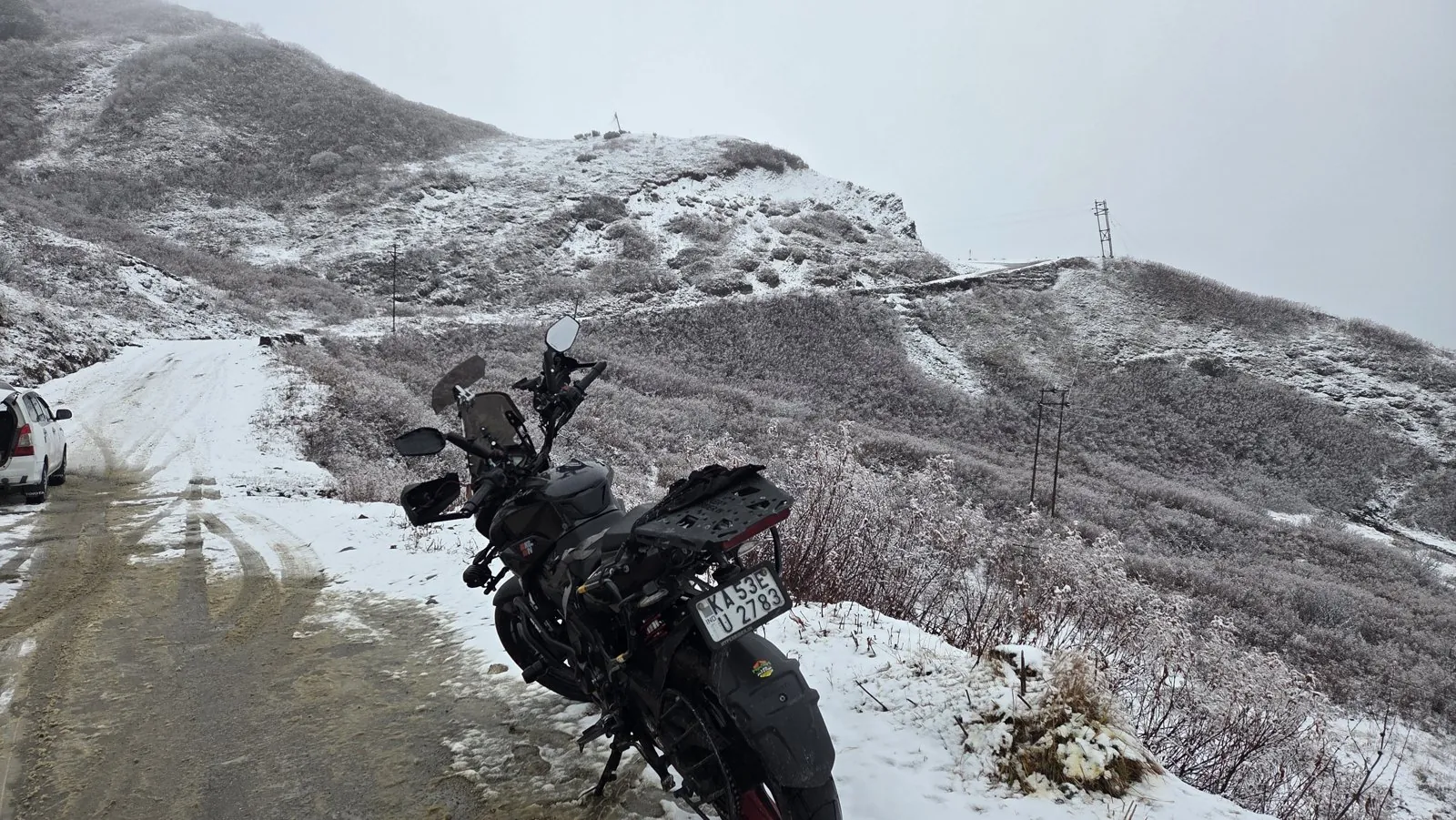
I rode this loop on my Pulsar NS200 in November 2025, coming up from Gangtok through Kupup and Baba Mandir, where ice formed on my visor, then down through Gnathang to Zuluk.
From Zuluk, at about 2,750 m, I rode down to Cooch Behar at about 46 m through Lava and the Dooars. That descent has its own post, the altitude drop from Zuluk to the plains. The shrine above Kupup has a story too: Baba Harbhajan Singh and Baba Mandir. And if you are wondering how many hairpins the Zuluk loops really have, see India's roads with the most hairpin bends.
The broader Northeast picture, with routes beyond Sikkim, is in my piece on the Northeast as India's touring frontier, and the Sikkim Diaries ride sits within the Ride Atlas.
What's new
- India-China border trade through Nathu La resumes after six years News On AIR, Aug 2026
- New paper argues regulation, not geography, keeps Nathu La trade small Indian Public Policy Review, Aug 2026
Questions people ask
Why is it called the Old Silk Route?
It was part of the network of trade roads linking India and Tibet, and through Tibet to the wider Silk Road. Wool, salt and hides were the main goods here more than silk; the name is mostly a modern tourism label for the Kalimpong-Jelep La road.
Can you visit Jelep La?
No. Jelep La has been closed since the 1962 war. You can see the area from viewpoints near Kupup, but the pass itself is not open to tourists or trade.
Do I need a permit for Zuluk?
Yes. Everything beyond the Lingtam check post needs a Protected Area Permit, processed at the District Tourism Office in Rongli, usually through your homestay. Foreigners also need a Restricted Area Permit for Sikkim.
When did Nathu La reopen for trade?
First on 6 July 2006, after 44 years, and again on 1 August 2026 after a suspension from 2020. Trade runs on set days in the summer and autumn season.
Did the British invasion of Tibet use this route?
Yes. Younghusband's force left Gnathang in Sikkim on 11 December 1903 and crossed into the Chumbi Valley, reaching Lhasa on 3 August 1904.
Sources
- Wikipedia: Jelep La (accessed 2026)
- Wikipedia: Zuluk (accessed 2026)
- Wikipedia: British expedition to Tibet (accessed 2026)
- Chettri P.: India-China Border Trade Through Nathu La Pass, HIMALAYA journal (2018)
- Vaishnav J.: Nathu La Pass Border Trade, Indian Public Policy Review (2026)
- News On AIR: India-China border trade through Nathu La resumes after six years (2026)
- Discover with Dheeraj: Sikkim permits guide (RAP, PAP, ILP) (2026)

Sapta (Saptarshi Sarkar) is a mechanical engineer turned marketer in Bengaluru and a solo touring rider. He writes the seven Saptaverse blogs. Work with him or read more of RoadHook Rides.


