Bhor Ghat is the pass at about 622 m on the crest of the Western Ghats between Khopoli and Khandala, and it has been the main road gate between Mumbai and Pune for two centuries. Sir John Malcolm opened a carriage road over it in 1830, the Great Indian Peninsula Railway finished its incline in 1863, the Mumbai-Pune Expressway went over it in 2002, and the Missing Link tunnels went under it on 1 May 2026. Motorcycles are barred from the expressway, so riders still climb the 18 km road ghat on old NH 48.
- About 550 m of climb in roughly 18 km separates Khopoli at the foot from Khandala at the top.
- 1830: Sir John Malcolm opens the first carriage road over the ghat.
- 1 in 37: the steepest grade on the 1863 railway incline, with 25 tunnels and 8 viaducts.
- 42,000 workers were on the incline at its January 1861 peak.
- NH 48 is the riders' route: two-wheelers are barred from the expressway and the 2026 Missing Link.
The Sahyadri escarpment rises almost straight out of the Konkan. A traveller leaving Bombay meets a wall of Deccan basalt, hundreds of metres high, with no river gorge to follow.
That geography made the Bhor Ghat crossing slow for centuries, and it explains why every new technology, from bullock carts to cable-stayed bridges, has been tested here first. This is the history in order, with the numbers.
Why was Bhor Ghat so hard to cross?
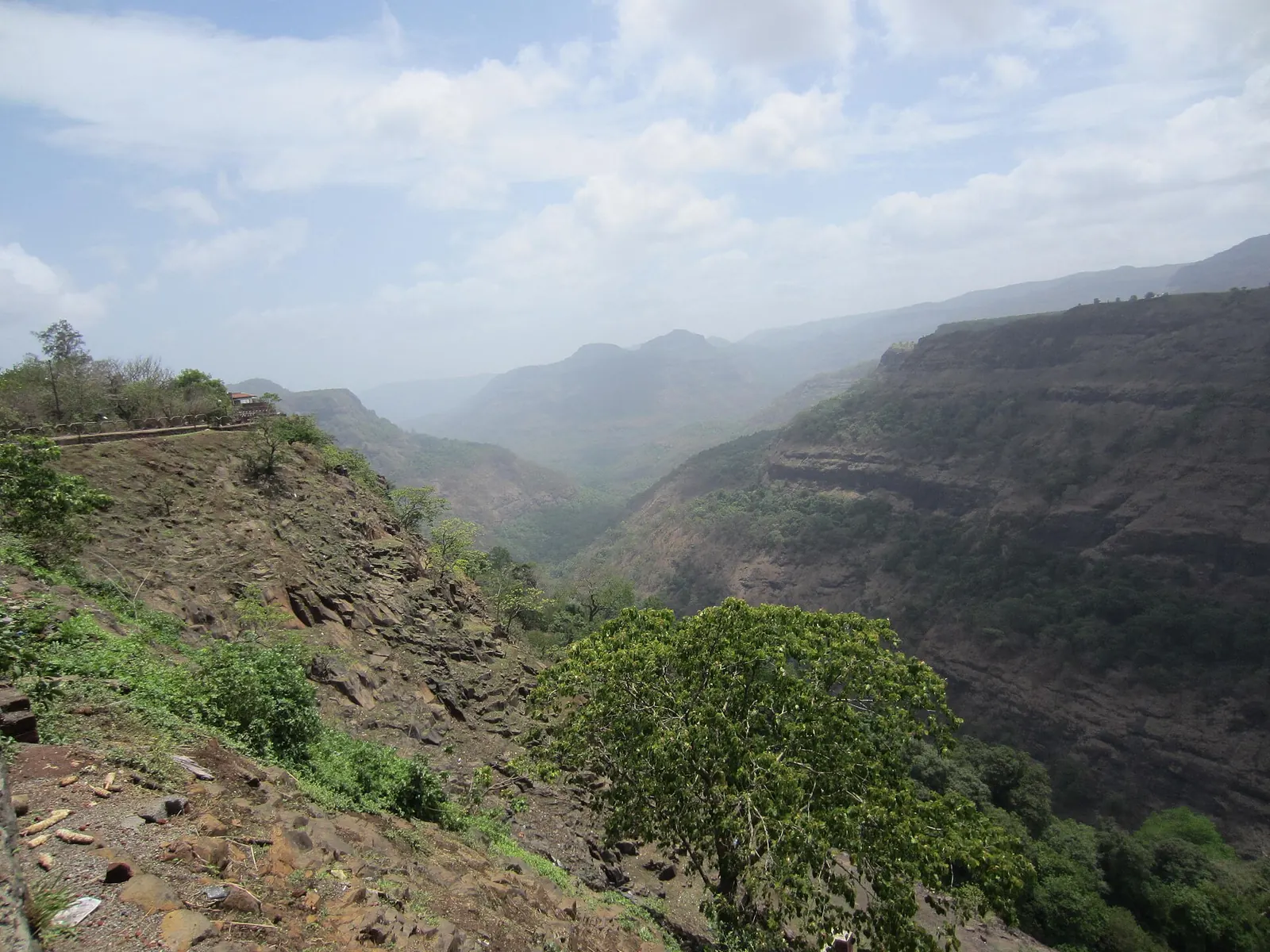
Bhor Ghat was hard because the Western Ghats here are a near-vertical basalt scarp with stepped lava flows, weak layers between them and monsoon rain that loosens blocks every year. Between Khopoli at the foot and Khandala at the top, the road gains roughly 550 m in about 18 km, and the railway has to make the same climb on a gradient no locomotive likes.
The rock itself
The geology is the Deccan Traps, Cretaceous lava flows stacked like a layer cake, with joints that let water in. Two engineering studies summarised further down show that the same features that made the climb hard in the 1850s still drop boulders on the expressway today.
In March 1859 the first contractor on the Bhor Ghat railway incline, William Frederick Faviell, gave up his contract after unrest among his workers. Two GIPR engineers, Swainson Adamson and George Clowser, kept the work going. In November 1859 the contract was let again, to Solomon Tredwell. He died within fifteen days of landing in India.
His widow, Alice Tredwell, did not hand it back. She took over the contract, returned to England, and left Adamson and Clowser to manage it in her name, an arrangement that lasted seven years. They kept about 25,000 men on the incline for two seasons, and more than 42,000 in 1861 (FIBIS, quoting the Thana District Gazetteer).
FIBIS: Bhore Ghat Railway ConstructionBefore the engineers
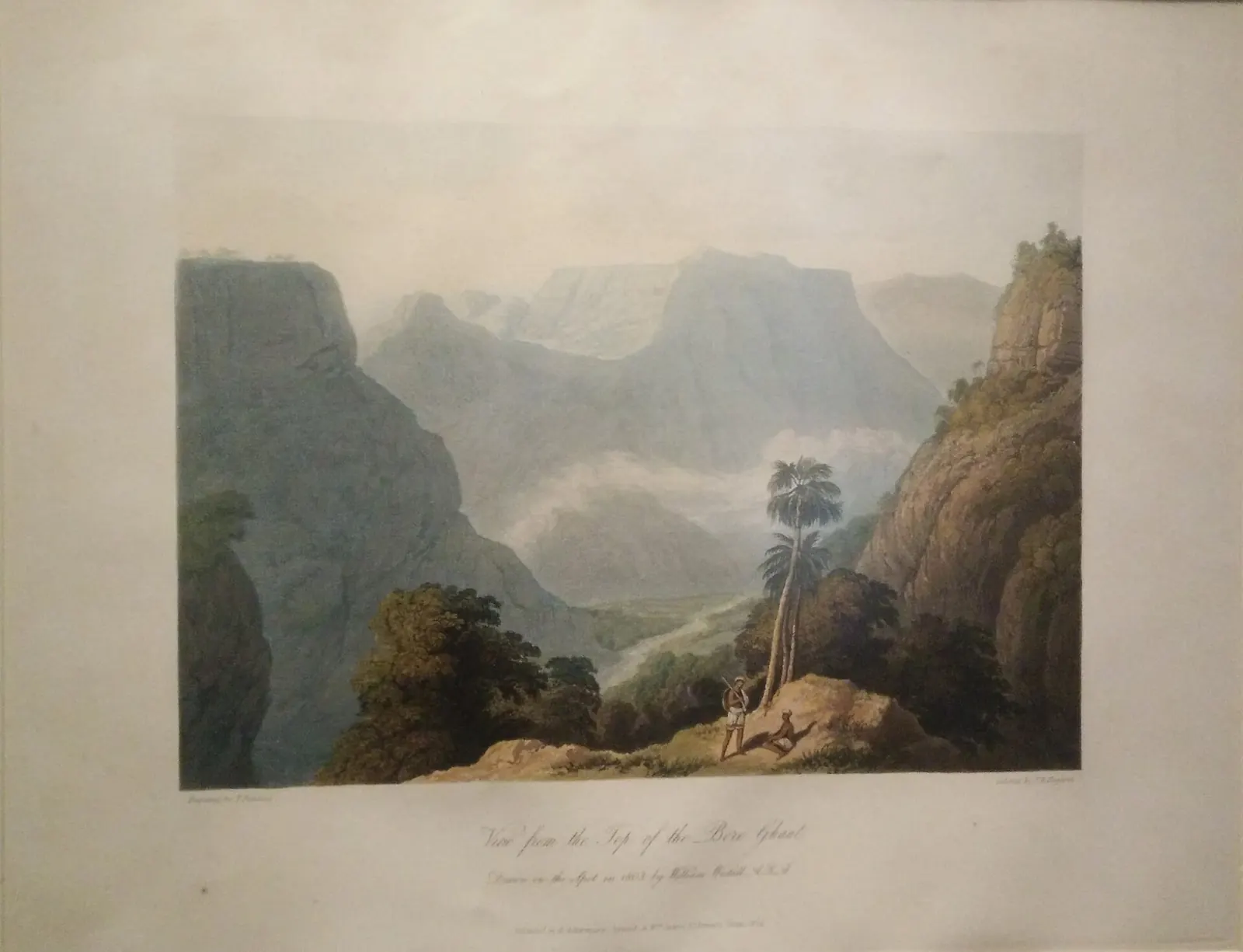
Before the British, the route was a footpath and pack-animal track. A popular local story credits a Dhangar herdsman, Shigroba, with showing engineers the line the road would take; it is widely repeated in Lonavala but rests on tradition rather than a documented source.
What is documented is the military value of the pass: British and Maratha forces fought along this route in 1779, in the campaign that ended at Wadgaon.
Who built the first road over Bhor Ghat?
The first engineered road came after the Second Anglo-Maratha War, and the first carriage road in 1830. After the Treaty of Bassein in 1803, Arthur Wellesley's administration built a road from the Bhor Ghat to Pune with stone paving and bridges, and the old Bombay-Poona highway still roughly follows it.
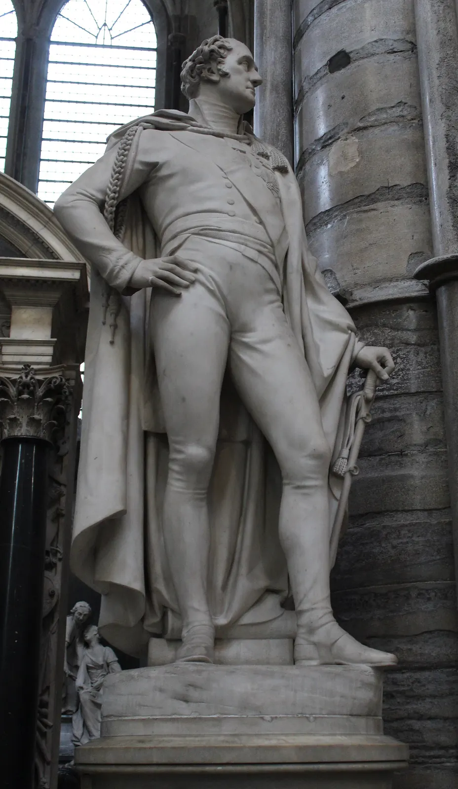
The ghat itself remained a struggle for wheeled traffic until 1830, when Sir John Malcolm, Governor of the Bombay Presidency, opened a refurbished road over the ghat fit for horse-drawn carriages.
From a week to a few days
According to a DNA history column by Aneesh Gokhale, the Bombay to Poona trip fell from about a week to three or four days once Wellesley's road was in use.
Relics of that early road were still visible in the 1870s according to the 1885 Bombay Gazetteer. The most famous survivor, the Amrutanjan bridge near Khandala, stood for about 190 years before the state road corporation demolished part of it on 6 April 2020, during the Covid lockdown, to clear a bottleneck on the expressway.
See the data as a table
| Approximate journey time (hours) | |
|---|---|
| Before 1803 (track) | 168 |
| After Wellesley road | 84 |
| Railway, 1901 | 4 |
| Expressway era | 2 |
Source: Aneesh Gokhale, The Bombay-Poona Road: Story of a highway, DNA (2018) · Converted from the column: about a week, 3 to 4 days (midpoint used), about four hours, a couple of hours.
How did the railway climb Bhor Ghat in 1863?
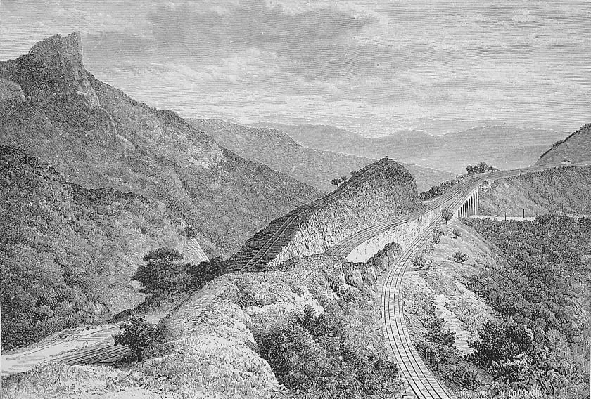
The Great Indian Peninsula Railway climbed Bhor Ghat with a 16-mile incline that rose over 1,800 feet on gradients of 1 in 40, with two miles at 1 in 37, through 25 tunnels and eight masonry viaducts (FIBIS; Wikipedia).
The engineers
- James John Berkley, chief engineer, surveyed and designed the route.
- Arthur Anderson West surveyed the incline itself.
- Robert Stephenson consulted from England until his death in 1859.
Work began on 24 January 1856.
The contractors and the cost
The contracting story, told in the box above, is grim: one contractor walked away, the next died within a fortnight, and his widow carried the job. Staff rose from 10,000 in 1856 to more than 20,000 in 1857 and peaked at about 42,000 in January 1861.
The incline cost about £1.1 million, roughly £70,000 a mile, and was formally opened at Khandala on 21 April 1863.

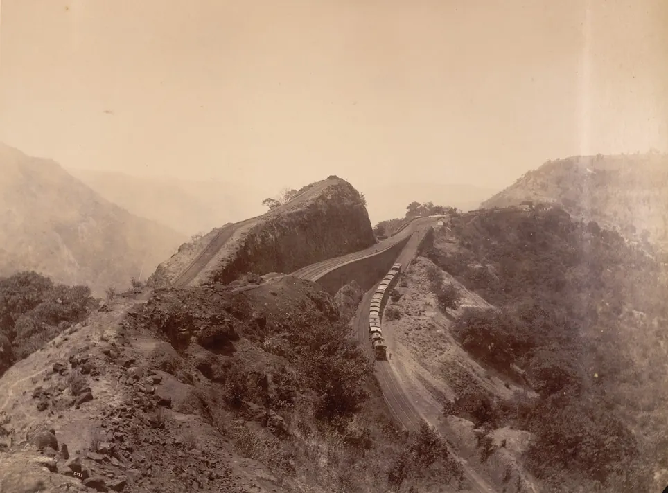
The reversing station
The reversing station was the incline's cleverest trick. Instead of a loop the hillside had no room for, trains ran onto a dead-end spur, stopped, and reversed up the next leg. A later realignment with new tunnels removed it.
Brakes, electricity and bankers
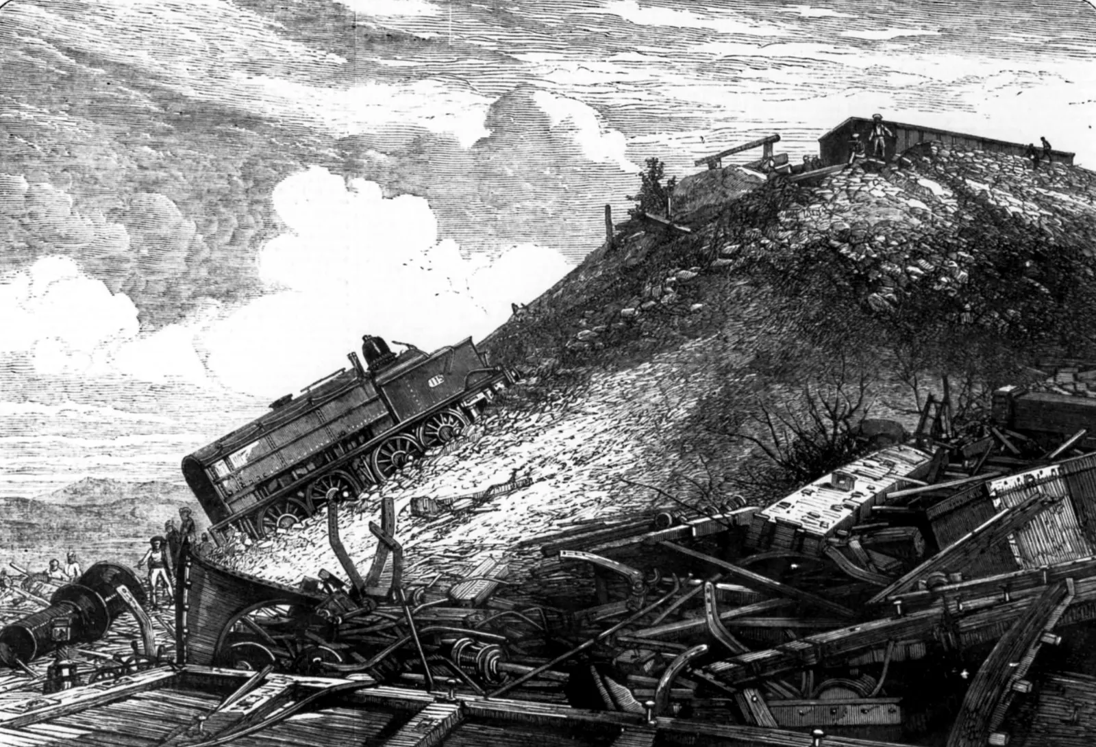
The incline also showed what a 1-in-37 grade does to brakes: in January 1869 a Poona-to-Bombay mail train lost its brakes on the ghat and went over the edge, killing 14 people.
- 1929 to 1930: electrification at 1.5 kV DC ended steam on the ghat.
- June 2015: the line moved to 25 kV AC.
- Today: banker locomotives still push heavy trains up between Karjat and Lonavala.
What did the Mumbai-Pune Expressway change in 2002?
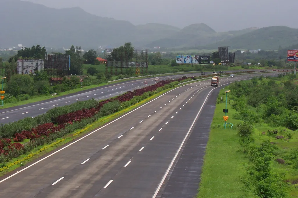
The expressway turned a two-lane ghat road into India's first six-lane, access-controlled concrete expressway. It is 94.5 km long from Kalamboli in Navi Mumbai to Kiwale near Pune, cost about ₹1,630 crore, opened in sections from 2000 and became fully operational in April 2002 (Wikipedia).
It was built with six tunnels, Bhatan, Madap, Adoshi, Khandala and two at Kamshet, totalling 5,724 m. The speed limit is 100 km/h for cars on flat stretches and 60 km/h in the hill section.
The end of the ghat for riders, on the new road
It also ended the Bhor Ghat for riders, at least on the new alignment. Pedestrians, bicycles, two-wheelers, three-wheelers, bullock carts and tractors are prohibited.
The old road, renumbered from NH 4 to NH 48 when the Gazette published the new national highway numbers on 28 April 2010, became the bikers' route by default. The debate on whether motorcycles should be allowed on Indian expressways is covered in a separate post on the expressway ban.
| Crossing | Opened | Length over the scarp | Steepest or key figure | Motorcycles? |
|---|---|---|---|---|
| Wellesley road to Pune | After 1803 | Bhor Ghat to Pune | Stone-paved, bridged | Not applicable |
| Malcolm's carriage road | 1830 | Khopoli to Khandala | First road fit for carriages | Not applicable |
| GIPR rail incline | 21 April 1863 | 16 miles (about 25.7 km) | 1 in 37; 25 tunnels; 8 viaducts | No |
| Old NH 4, now NH 48 road ghat | Upgraded through the 20th century | 18 km | Hairpins, mixed heavy traffic | Yes |
| Expressway ghat section | 2002 | 19.8 km Khandala ghat stretch | 60 km/h limit in the hills | No |
| Missing Link | 1 May 2026 | 13.3 km | 8.9 km tunnel; 650 m cable-stayed bridge | No |
Why does Bhor Ghat still have rockfalls?
Bhor Ghat still sheds rock because jointed basalt, weak interlayers and very heavy monsoon rain are a permanent combination. Cutting wider roads exposes more faces. The two studies below put numbers on it, and the warnings they give match what happened in July 2026.
A field case history written after major rockfalls and landslides in 2003 and 2004 caused accidents and casualties. The authors studied a problem area at km 41 next to the Adoshi tunnel, where a 500 m stretch of embankment had subsided by 2 to 3 m, and identified 17 critical rockfall locations along the expressway for investigation and mitigation. They combined geological, geomorphological and geotechnical surveys with stability analysis and recommended drainage, steel rope nets and fibre-reinforced shotcrete. Limit: it is a case history, so it shows causes and fixes at chosen sites rather than a statistical risk estimate for the whole ghat.
Read the paper (free)The team modelled a hill-cut slope near the Khandala tunnel, where heavy rain in June and July 2015 triggered a rockfall that halted traffic for almost two months. Using rockfall trajectory simulation and finite-element slope analysis, they found a factor of safety of 1.48 in dry conditions that falls to 1.07 in the rains, close to failure. Simulated boulders reached both carriageways with bounce heights of about 9 to 10 m, translational velocity of about 16 m/s and total kinetic energy of about 500 kJ, the highest hazard class. Three joint sets plus torrential rain were the main drivers. Limit: one slope, two-dimensional analysis, and input parameters estimated from field tests.
Read the paper (free)A factor of safety of 1.48 when dry falls to 1.07 in the rains. On the ghat, the monsoon is the difference between a slope and a rockfall.

What is the Missing Link, and did it fix the ghat?
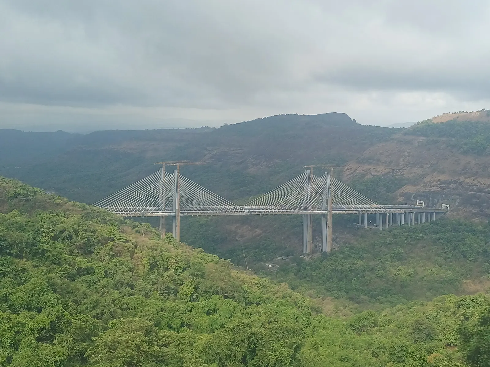
The Missing Link is a 13.3 km, eight-lane bypass with two tunnels and a cable-stayed bridge that takes expressway traffic under and around the Khandala ghat. It replaces the 19.8 km climb, saves about 6 km and 25 to 30 minutes, and cost ₹6,695 crore.
The numbers
- Tunnel: the longer one runs for about 8.9 km at depths of up to about 180 m below the surface (News Arena India).
- Bridge: a 650 m cable-stayed span crosses Tiger Valley near Lonavala (reports give its height as anything from 125 m to 183 m).
- Timeline: conceived in 1995, approved in 2017, started in 2019, opened on 1 May 2026, after its deadline slipped several times from an original March 2024 target.
The ghat answers back
The ghat had the last word quickly. On 6 July 2026, two months after opening, heavy rain brought landslides near the Missing Link and damaged its cable-stayed bridge; the Mumbai-bound carriageway was shut for a few hours while debris was cleared, and traffic went back over the old ghat and NH 48.
One closure does not condemn a project, but it shows that tunnels change where the risk sits, not whether it exists. For how hairpin roads like the old ghat are designed in the first place, read the post on ghat road design.
What's new
- Mumbai-Pune Expressway Missing Link opens with an 8.9 km tunnel and a cable-stayed bridge over Tiger Valley News Arena India, May 2026
- Maharashtra CM inaugurates the Missing Link, replacing the 19.8 km Khandala ghat stretch Autocar India, May 2026
- Missing Link carriageway shut after rain-triggered landslides on 6 July 2026 (summary of India Today and ThePrint reports) Wikipedia, updated Oct 2026
How should a rider take Bhor Ghat today?
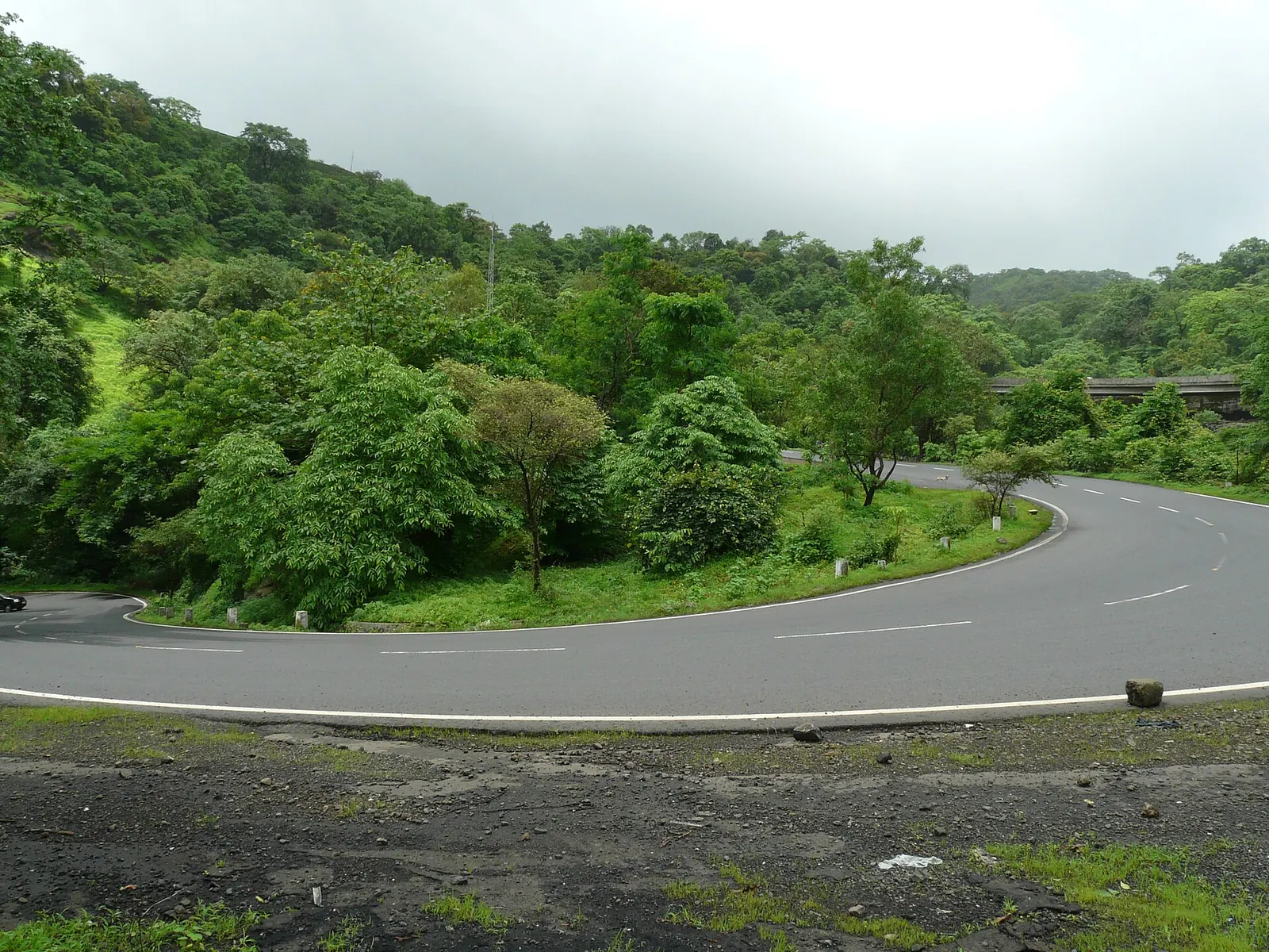
A rider takes Bhor Ghat on old NH 48 through Khopoli, Khandala and Lonavala, because the expressway and the Missing Link are closed to two-wheelers. The road ghat is 18 km of hairpins shared with buses, trucks and weekend traffic to Lonavala.
The main risks are overtaking buses on blind bends, and diesel or gravel on the apex. Practical points:
- Climb early. Weekend tourist traffic to Lonavala and Khandala builds after mid-morning, and monsoon fog thickens in the afternoon.
- Use engine braking on the descent. The 1869 mail train is the ghat's oldest lesson about brakes and long downgrades.
- Expect water on the road June to September. This side of the Sahyadris is among the wettest belts in India; see the wettest-places list for what that rain does to roads.
- Link it with the coast. From Pune or Mumbai, the Konkan route south is the natural continuation; the Konkan coastal highway guide covers it.
Bhor Ghat is one of India's great old trade climbs, in the same family as the Grand Trunk Road. The rest of the Ride Atlas is on the Yatri page.
Questions people ask
Can I ride a motorcycle on the Mumbai-Pune Expressway?
No. Two-wheelers, three-wheelers, bicycles, pedestrians, bullock carts and tractors are prohibited on the expressway and on the Missing Link. Riders use old NH 48 through the Khandala ghat.
Where exactly is Bhor Ghat?
The road ghat runs about 18 km between Khopoli at the foot and Khandala at the top, in Raigad and Pune districts of Maharashtra. The railway incline runs between Palasdari and Khandala, and the pass sits at about 622 m.
How many tunnels does the Bhor Ghat railway have?
The original 1863 incline had 25 tunnels and 8 viaducts. Later realignments, including the removal of the reversing station, changed the count, and sources today give figures from 26 to 28 for the ghat section.
Is the old Khandala ghat safe in the monsoon?
It is ridden daily, but rockfall risk rises sharply in heavy rain. An IIT Bombay study found the factor of safety of one slope near the Khandala tunnel falling from 1.48 dry to 1.07 wet. Ride in daylight and avoid stopping under cuttings.
Sources
- Wikipedia: Bhor Ghat (accessed 2026)
- FIBIS: Bhore Ghat Railway Construction (source for the Tredwell contract story) (accessed 2026)
- Aneesh Gokhale: The Bombay-Poona Road, story of a highway, DNA (2018)
- Wikipedia: Mumbai-Pune Expressway (accessed 2026)
- Kumar et al.: Rockfall and Subsidence on Mumbai-Pune Expressway, IJGCH (2010)
- Sharma et al.: Assessment of rockfall hazard along Mumbai-Pune Expressway, Acta Geodynamica et Geomaterialia (2020)
- News Arena India: Mumbai-Pune Expressway Missing Link finally opens (2026)
- Autocar India: Maharashtra CM inaugurates the Missing Link (2026)
- Wikipedia: List of national highways in India (2010 renumbering) (accessed 2026)

Sapta (Saptarshi Sarkar) is a mechanical engineer turned marketer in Bengaluru and a solo touring rider. He writes the seven Saptaverse blogs. Work with him or read more of RoadHook Rides.