
Yes, a beginner can ride the Spiti circuit, but only a prepared one: a few thousand kilometres of ordinary riding, at least one hill trip before, a June or September window, and the Shimla-Kinnaur side first so the body climbs slowly to Kaza at 3,650 m. A rider who has never handled gravel, a water crossing or a loaded bike on a slope should practise those first, and nobody should ride Spiti for the first time in the July-August monsoon.
- Shimla side first: the clockwise loop raises your sleeping altitude in steps to Kaza at 3,650 m.
- Kunzum (4,551 m) on day one from Manali is the hardest way in for a beginner.
- 43% of Kinnaur's surveyed road was damaged in a 2016 GPS audit, concentrated around Karcham-Wangtu and Malling.
- 10,000 km on your own bike roughly halved injury-crash risk in a case-control study; years of riding did not.
- June or September, days ending by 4 pm, and water crossings before 10 am.
The question shows up on every riding forum in some form: "first long trip, is Spiti OK?" One of the most honest answers is a 2016 Tripoto trip report by a rider who had never done more than 100 km a day on plain roads before he set off for Spiti alone.
Pranit Naik left Delhi alone for Spiti at 5 am on 13 August 2016, admitting he had never ridden more than 100 km in a day, and only on plain roads. Day one was 430 km to Narkanda, in rain and then fog so thick from 5 pm that he could see about a metre ahead.
Two days later he rode gravel in the dark from Nako to Tabo at 40 to 60 km/h, dodging potholes, damaged the front fork's oil seal and reached Tabo at 8 pm. Near Rohtang, in ankle-deep uphill mud, the bike would not move even at 6,000 rpm in second gear; three men helped push it, and a Manali mechanic found the clutch cable stuck. He finished the circuit, 1,833 km in all, and reached Noida at 1:30 am on 21 August.
Pranit Tulsidas Naik, Tripoto: Spiti, a rider is born (2016)His account reads like a list of beginner traps: a 430 km first day, riding into the dark, a damaged fork seal, a stuck clutch cable, about eight water crossings between Chandratal and Manali, and 20 to 30 km/h on a road under construction on day one.
Spiti did not stop him. It just charged him for every gap in preparation.
This post is about closing those gaps before you go.
How hard is a Spiti bike trip for beginners, really?
A Spiti bike trip is moderate on the Shimla-Kinnaur side and hard on the Manali-Kunzum side, and the hard part is surface, not gradient.
- Kinnaur's NH-5 is mostly paved but broken by landslide zones.
- Gramphu-Batal-Kunzum is the roughest stretch, with loose boulders and running water.
The table pulls together the stretches a first-timer should know, with the source for each.
| Stretch | What you ride on | Why it matters for a beginner |
|---|---|---|
| Narkanda to Jeori | About 24 km partially damaged (2016 GPS survey) | First taste of broken tarmac; ride it in daylight |
| Jeori to Karcham (54 km) | 18 km fully damaged, 12.4 km partially (2016) | Hydropower construction and slides; trucks and dust |
| Reckong Peo to Nako (103 km) | 65.9 km good, 33.3 km partially damaged (2016) | Malling Nala near Nako: the most closure-prone point, no bypass |
| Nako to Tabo to Kaza | Narrow road into Spiti | Altitude jumps from about 2,290 m (Reckong Peo) to 3,625 m (Nako) |
| Kaza to Losar | BRO widening under way in 2026 | Construction gravel; a washout near Chicham bridge was reported in July 2026 |
| Losar to Kunzum (4,551 m) | Rough, thin air | Highest point; altitude illness possible |
| Kunzum to Batal to Gramphu (about 47 km for Gramphu-Batal) | Broken surface, loose boulders, water crossings | Allow 4 to 5 hours; water is lowest before 10 am |
The 2016 survey figures come from a GPS road audit published in 2023 (research card below); the 2026 notes come from a road-status page that was verified against Himachal's State Emergency Operation Centre report of 5 September 2026. Conditions on NH-5 change every monsoon, so read the table as "where to expect trouble", not "what the road is like today".
See the data as a table
| Good (km) | Partially damaged (km) | Fully damaged (km) | |
|---|---|---|---|
| Jeori-Karcham | 23.6 | 12.41 | 17.99 |
| Karcham-Reckong Peo | 9.56 | 4.91 | 8.53 |
| Reckong Peo-Nako | 65.86 | 33.28 | 3.86 |
| Nako-Sumdo | 29.53 | 6.47 | 0 |
Source: Jangra et al. (2023), Environment, Development and Sustainability, GPS survey of 2016 · Survey from 2016; some stretches have since been rebuilt and others damaged again.
The authors walked and rode Kinnaur's main routes with a Garmin handheld GPS, classifying each stretch as good, partially damaged (surface washed out or under repair) or fully damaged, and surveyed 280 tourists on transport. Of 262.1 km surveyed, 113.92 km (43.45%) was not in good condition; the worst single patch was 17.99 km of fully damaged road between Wangtu and Karcham, blamed on landslides and blasting for hydropower tunnels, and the Nako-Malling patch had been on landslide alert for over a year. Kinnaur's metalled road density was 8.42 km per 100 sq km against a state average of 51.92. Limit: the GPS work dates from 2016, so the exact kilometres have changed, but the pattern (damage concentrated around Karcham-Wangtu and Malling) still matches recent closure reports.
Read the paper (free)Which direction is safer for a first Spiti ride?
The Shimla-Kinnaur-Kaza-Manali direction is safer for a beginner, because it raises your sleeping altitude in steps and leaves the roughest stretch for the end, when you are acclimatised and used to the bike. Going the other way, you ride from Manali over Kunzum (4,551 m) to Kaza in one 180 to 200 km day that a 2026 road-status page puts at 8 to 12 hours, with the Gramphu-Batal water crossings on day one.
The altitude logic is the stronger argument. CDC's 2026 Yellow Book advises that above 3,000 m you raise your sleeping altitude by no more than 500 m a day and add a rest day for every 1,000 m gained.
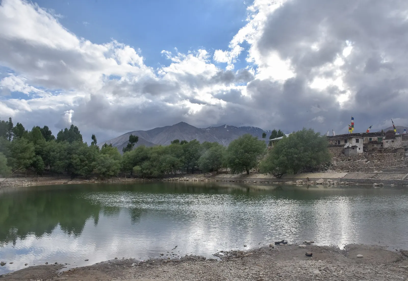
On the Kinnaur side, you can sleep at Reckong Peo (about 2,290 m), then Nako (3,625 m) or Tabo, then Kaza (3,650 m), and spend a day around Kaza before crossing Kunzum. On the Manali side, there is no gentle way to make that jump. The 2016 Tripoto rider went clockwise, and the troubles he describes are mechanical and about daylight.
| Point | Altitude (m) | Note |
|---|---|---|
| Reckong Peo | 2,290 | Kinnaur HQ, fuel and ATMs |
| Nako | 3,625 | 7 km off NH-505 |
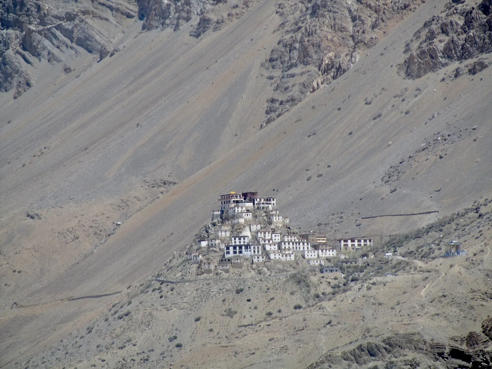
| Kaza | 3,650 | Fuel, the only real town in Spiti |
| Kibber | about 4,330 (14,200 ft) | Day ride from Kaza |
| Kunzum Pass | 4,551 | Usually opens in late May |
There is one honest case for anticlockwise: if you have only six or seven days and live in Chandigarh or Delhi, Manali is closer. In that case, spend a night at a mid-altitude stop before Kunzum and start the Batal stretch early. The detailed day plans are in my Spiti valley bike trip guide.
Use this to check your own sleeping plan against the CDC rule before you book a single room.
How many nights should this climb take?

What skills should a beginner practise before Spiti?
Practise four skills before Spiti: standing on the pegs over gravel, crossing running water at walking pace, holding a loaded bike on a steep slope with the rear brake, and picking a dropped bike up alone. These are the situations the Tripoto rider met, and none of them shows up on a city commute.
- Gravel at 20 to 30 km/h, standing. Find a broken service road or a dirt track and ride it standing, knees gripping the tank, eyes up. Spiti's rough stretches are long, not technical; fatigue comes from sitting and fighting the bars.
- Water crossings. Walk shallow ones first, pick the line with the smallest stones, stay in first or second gear and keep a steady throttle. Cross the Batal side before about 10 am, when meltwater is lowest. My water crossing technique post covers lines and gear.
- Hill starts with luggage. Load the bike as you will in Spiti and practise starting on a steep ramp with the rear brake held. Most low-speed drops on mountain roads happen on uphill hairpins.
- Lifting the bike. If you cannot lift your loaded bike alone, either lighten it or ride with someone who can help.
- Basic fixes. Plug a tubeless puncture or change a tube, adjust a clutch cable, and tighten a chain. The Tripoto rider's "dead clutch" near Rohtang turned out to be a stuck cable, which a Manali mechanic diagnosed; the plates were fine.
Does riding experience actually reduce crash risk?
Experience helps, but the most protective kind is familiarity with the specific motorcycle, not years of riding. That finding from a well-known case-control study matters for Spiti because many beginners rent an unfamiliar bike in Shimla or Manali the day they set off.
A population-based case-control study in Auckland, New Zealand, comparing 490 motorcycle riders in injury crashes with 1,518 riders stopped at random roadside surveys, over three years from February 1993. Riders over 25 had less than half the risk of riders aged 15 to 19 (odds ratio 0.46). Years of riding looked protective at first, but that effect vanished once age and other factors were controlled. The one experience measure that stayed strongly protective was distance ridden on the specific motorcycle: 10,000 km or more cut the risk roughly in half (odds ratio 0.52). Limit: urban and suburban New Zealand roads from the 1990s, not Himalayan gravel; the direction of the finding is what transfers.
Read the paper (free)The practical reading: if you can, ride your own bike, even a smaller one, rather than a rental you met yesterday. If you must rent, take it for a half-day loaded ride before leaving, and check the brakes, chain and tyres yourself. If you own a small commuter, read whether a 125cc or 150cc bike can handle high passes; most of that logic applies to Kunzum.
When should a beginner not ride Spiti?
A beginner should not ride Spiti in July and August, should not attempt it as a first-ever hill trip, and should not plan days that end after dark. The monsoon is the biggest single risk because the Kinnaur side, which is the safer route for altitude, is also the most landslide-prone.
- Monsoon (July to August). On 3 July 2026, a flash flood near Choling in Kinnaur buried vehicles under debris and blocked NH-5 overnight. A global study of 4,862 fatal landslides found that rainfall triggered 79% of them and that India and Nepal accounted for about 21% of rainfall-triggered events worldwide, concentrated in the monsoon.
- Late season (mid-October onward). Kunzum closed from 6 October 2025 after heavy snow and reopened only to light 4x4 vehicles about eight days later, according to The Tribune. A beginner on two wheels has no business on fresh snow and black ice.
- Your first ever mountain ride. Do a shorter hill loop first, even a weekend in the Western Ghats or Shimla-Narkanda, so that hairpins and oncoming trucks are not new on top of altitude.
- Night riding. The 2016 Tripoto rider damaged his fork seal riding gravel in the dark to reach Tabo. Plan days to end by 4 pm; Spiti's long gaps leave no room for a late start.
- Solo, with no network plan. A 2026 road-status page reports mobile gaps between Gramphu and Kaza, near Kunzum and around Chandratal, and recommends BSNL postpaid as the widest network. If you go alone, leave a day-by-day plan with someone at home.

What does a realistic beginner plan look like?
A realistic beginner plan is eight to ten riding days from Shimla to Manali, with no day longer than about 200 km in the mountains and one spare day for weather. Fuel is available at Reckong Peo, Tabo and Kaza, and there is no reliable fuel between Kaza and Manali, so leave Kaza with a full tank and a reserve.
| Day | Plan | Why |
|---|---|---|
| 1 | Shimla to Narkanda or Rampur | Short first day, settle the load |
| 2 | To Reckong Peo or Kalpa | Karcham-Wangtu damage zone in daylight |
| 3 | To Nako | First night above 3,500 m; Malling Nala early in the day |
| 4 | Nako to Tabo | Short, easy acclimatisation day |
| 5 | Tabo to Kaza via Dhankar | Arrive early, rest |
| 6 | Kaza day loop (Key, Kibber) | Climb high, sleep low |
| 7 | Kaza to Chandratal or Batal | Cross Kunzum before noon |
| 8 | To Manali via Gramphu and Atal Tunnel | Water crossings before 10 am |
| 9 to 10 | Buffer | Slides, closures or a tired rider |
For more on the whole region and its passes, see the Yatri page, and for what goes on the bike, my gear notes.

What's new
- Flash flood near Choling blocks NH-5 in Kinnaur and buries vehicles under debris News Arena India, Jul 2026
- Spiti road status checked against the state emergency centre report, both routes open Travel Coffee, Sep 2026
- Kunzum Pass reopened only to light 4x4 vehicles after snow shut it from 6 October The Tribune, Oct 2025
Questions people ask
Is Spiti easier than Ladakh for a first Himalayan ride?
Spiti is shorter and its highest point (Kunzum, 4,551 m) is lower than the passes on the Manali-Leh highway, which reach 5,328 m at Tanglang La. Its roads are not smoother, though, and Kinnaur's landslide zones make it riskier in the monsoon.
Which bike is best for Spiti for a beginner?
The one you know best. A case-control study found that 10,000 km or more on the specific motorcycle roughly halved injury-crash risk. A light, upright bike you can pick up yourself matters more than engine size.
Can I ride Spiti in October?
Early October is possible on the Shimla side, but Kunzum can shut at short notice: snow closed it from 6 October in 2025. Treat the Manali-Kaza road as uncertain from mid-October and plan to exit via Shimla.
How many days do I need for Spiti on a bike?
Eight to ten days from Shimla to Manali for a beginner, including a rest day at Kaza and one spare day for weather. Shimla to Kaza alone is 468 km by the existing road.
Sources
- Tripoto: Spiti, a rider is born (trip report) (2016)
- Jangra, R. et al.: The role of transportation in developing the tourism sector at high altitude destination, Kinnaur. Environment, Development and Sustainability (2023)
- Mullin, B. et al.: Increasing age and experience: are both protective against motorcycle injury? Injury Prevention (2000)
- Froude, M. J. and Petley, D. N.: Global fatal landslide occurrence from 2004 to 2016. Natural Hazards and Earth System Sciences (2018)
- CDC Yellow Book 2026: High-altitude travel and altitude illness (2025)
- Travel Coffee: Spiti valley road status (Sep 2026)
- The Tribune: Kunzum Pass thrown open for 4x4 vehicles (Oct 2025)
- News Arena India: Heavy rain triggers flash flood, blocks NH-5 in Kinnaur (Jul 2026)
- Wikipedia: Kaza, Himachal Pradesh (altitude, road distance)
- Wikipedia: Nako (altitude)
- Wikipedia: Reckong Peo (altitude)

Sapta (Saptarshi Sarkar) is a mechanical engineer turned marketer in Bengaluru and a solo touring rider. He writes the seven Saptaverse blogs. Work with him or read more of RoadHook Rides.


