
The highest lake in India you can reach by road is Gurudongmar in North Sikkim, at roughly 5,150 m on topographic data (the Sikkim government signposts 17,800 ft, about 5,430 m). After it come Suraj Tal on the Manali–Leh highway (4,883 m), Tso Kar (4,530 m) and Tso Moriri (4,522 m) in Ladakh. Every lake on this list sits above 3,700 m, so the real limits are permits, the months the road is open and your body's response to thin air.
- Gurudongmar is the highest road-accessible lake: about 5,154 m on survey data, 5,430 m by the Sikkim government.
- Suraj Tal (4,883 m) is the highest lake right beside a national highway, on the Manali–Leh road.
- Four of eight lakes sit above 4,500 m, where more than half of fast ascenders get mountain sickness.
- About 52% of sea-level air pressure is all you get at Gurudongmar, for your lungs and your engine.
- Permits: Gurudongmar, Tso Moriri, Pangong, Sela and Tsomgo need one; Suraj Tal and Chandra Taal do not for Indians.
This list ranks lakes by surface altitude, using the figure in each lake's survey record or official listing. "By road" means a motorable road reaches the shore or stops within a short walk of it.
I left out lakes that need a trek (Bhrigu, Hemkund) and lakes that civilians cannot visit at all. Where sources disagree on altitude, I give both numbers and say which one I used.
On 4 April 2023, because of bad weather, the police in Gangtok issued passes on the Jawaharlal Nehru Road only up to 15 Mile, short of Tsomgo Lake. More than 500 vehicle passes went out for that stretch, and between 13 Mile and 15 Mile tourists stopped to play in the snow.
Then an avalanche came down on them. Karka Bahadur, a driver with 25 years on the route, had just passed 13 Mile and was about 15 to 20 feet away; he said the ground shook and a mass of snow swallowed the tourists. Seven people died and 13 were admitted to hospital in Gangtok. The Gangtok SP said they had ignored warnings and stopped where the avalanche struck, and the chief minister said future trips to such spots would need weather clearance from the IMD.
The Quint: Driver who witnessed the Sikkim avalanche, and tourists, narrateThat is the practical side of altitude this post keeps returning to.
See the data as a table
| Altitude (m) | |
|---|---|
| Gurudongmar (Sikkim) | 5154 |
| Suraj Tal (Himachal) | 4883 |
| Tso Kar (Ladakh) | 4530 |
| Tso Moriri (Ladakh) | 4522 |
| Pangong Tso (Ladakh) | 4328 |
| Chandra Taal (Himachal) | 4250 |
| Sela Lake (Arunachal) | 4160 |
| Tsomgo (Sikkim) | 3753 |
Source: Wikipedia lake infoboxes (Gurudongmar, Suraj Tal, Tso Kar, Tso Moriri, Pangong Tso, Chandra Taal, Sela Pass, Tsomgo) · Gurudongmar uses the infobox survey value; the Sikkim government quotes 5,430 m. Pangong is 14,200 ft converted.
Which lakes can you actually ride to, and how high are they?
Eight lakes in India sit above 3,700 m with a road to the shore, and four of them are above 4,500 m. The table below is the whole ranking in one place, with the permit and the season, so you can see which ones fit the same trip.
| Rank | Lake | State/UT | Altitude (m) | Permit for Indian riders | Road usually open |
|---|---|---|---|---|---|
| 1 | Gurudongmar | Sikkim | 5,154 (official claim 5,430) | Protected Area Permit via Mangan district; foreigners not allowed | Lake frozen Nov to mid-May; road subject to post-2023 repairs |
| 2 | Suraj Tal | Himachal (Lahaul) | 4,883 | None | Pass road closed Nov to Apr |
| 3 | Tso Kar | Ladakh | 4,530 | Check LAHDC portal | With Manali–Leh season |
| 4 | Tso Moriri | Ladakh | 4,522 | LAHDC protected-area permit | Summer |
| 5 | Pangong Tso | Ladakh | about 4,328 | LAHDC protected-area permit | Summer; lake freezes in winter |
| 6 | Chandra Taal | Himachal (Spiti) | 4,250 | None | Late May to early Oct |
| 7 | Sela Lake | Arunachal | about 4,160 | Arunachal Inner Line Permit | All year via Sela tunnel; lake freezes in winter |
| 8 | Tsomgo | Sikkim | 3,753 | Restricted-area permit | All year; ice can last to May |
Two patterns stand out:
- The four highest lakes are all in rain-shadow cold desert (North Sikkim's plateau, Lahaul, Changthang), where roads open only after snow clearance.
- The two lowest, Sela and Tsomgo, sit on all-season army roads, which is why they get the most visitors and the most accidents on ice.
1. Gurudongmar Lake, North Sikkim
Gurudongmar is the highest lake in India reachable by a road, a moraine-dammed glacial lake about 5 km south of the Chinese border and about 190 km from Gangtok.
The altitude is disputed: the Sikkim government quotes 5,430 m (17,800 ft), while the survey value used in its Wikipedia record is 5,154 m and terrain maps show just under 5,150 m. Either way, nothing else on this list comes close.
The lake and the road
The lake covers 118 hectares and is fed by the Gurudongmar glacier; one of its outflow streams joins Tso Lhamo, the source of the Teesta. It stays fully frozen from November to mid-May.
The road is NH310C, about 100 km from Chungthang through Lachen and the Thangu valley. The last stretch above Thangu crosses moraine and open pasture with no shelter.
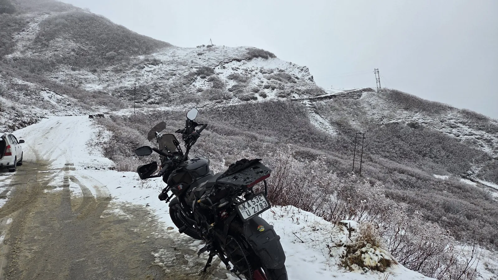
Access since the 2023 flood
Access has been the bigger problem than altitude. The October 2023 glacial lake outburst flood from South Lhonak Lake wrecked the Teesta valley roads, and Lachen stayed shut to tourists for more than two years.
Permits for Lachen and Gurudongmar resumed in March 2026 after the 400-foot Taram Chu bridge opened, a single-lane crossing that takes one vehicle at a time. Foreign nationals cannot visit at all because the lake is so close to the border.
- Altitude: 5,154 m (survey) / 5,430 m (Sikkim govt)
- Base: Lachen or Thangu
- Best window: May to October, after the ice breaks
2. Suraj Tal, Lahaul
Suraj Tal is the highest lake you can ride past without leaving a national highway: NH3, the Manali–Leh road, skirts its shore at 4,883 m, about 3 km below Baralacha La. It is small, roughly 800 m long, and it is the source of the Bhaga river, which later meets the Chandra at Tandi to become the Chenab.
It is also the lake most riders see without planning to. It sits 65 km from Keylong, and the road closes from November to April when Baralacha La is snowbound. Because you arrive from Jispa (about 3,200 m) and climb 1,700 m in a morning, Suraj Tal is often where altitude headaches start on the Manali side.

3. Tso Kar, Changthang
Tso Kar is a hypersaline lake at 4,530 m, about 30 km east of the Manali–Leh road, reached from Miru or from the Debring side of the More plains. Its name refers to the white salt crust on its margins. It became a Ramsar wetland in 2020.
Its surface area is given as 22 km² in one record and about 18 km² in the Ramsar description, a gap that reflects how much a shallow salt lake shrinks in a dry year. For riders it is the easiest high lake to add to a Manali–Leh run, since the turn-off is on the highway itself.
4. Tso Moriri, Rupshu
Tso Moriri sits at 4,522 m, is about 26 km long and up to 8 km wide, and became a Ramsar site on 19 August 2002. Karzok, on its north-west shore, is the only year-round settlement, and the village itself sits at about 4,595 m, which makes a night there one of the highest sleeps on any Indian bike route.
The main road comes in from the north via Sumdo and the Mahe side. A new road from Kiato in Spiti via the Takling La tunnel is under construction, which would one day make Tso Moriri a southern entry point to Ladakh. The lake needs the Ladakh protected-area permit from the LAHDC portal.
- Altitude: 4,522 m
- Length: 26 km
- Catchment: 2,298 km²
5. Pangong Tso, eastern Ladakh
Pangong Tso is the best known lake on the list and the fifth highest, at about 14,200 ft (4,328 m). It is 134 km long, and about two-thirds of it lies in China-administered territory. The eastern end is fresh to slightly saline (about 0.68 g/L dissolved solids) and the western end in India is clearly saline (about 11 g/L).

The Indian side needs a protected-area permit, groups need an accredited guide, and boating is banned for security reasons.
Most riders cross Chang La (about 5,360 m) from Leh to get here, which means the climb to the pass is higher than the lake itself. That is the detail people forget when they plan Pangong as a day trip from Leh on their second day.
6. Chandra Taal, Spiti
Chandra Taal lies at 4,250 m, covers about 49 hectares, and became a Ramsar site in November 2005. The access road leaves NH505 about 2.9 km from Batal and 8 km from Kunzum Pass, and the lake is reachable from late May to early October.

For a rider doing the Spiti circuit, Chandra Taal is a detour of a few hours from the Kaza–Manali road. Camps operate near the lake in season. If you are coming from Kaza, you will already have spent several nights above 3,500 m, which is the best way to arrive here.
7. Sela Lake, Tawang road
Sela Lake lies just north of Sela Pass at about 4,160 m on the road to Tawang, and it drains into the Nuranang river. Local Buddhists count it among about 101 sacred lakes in the area. Since March 2024 the Sela tunnel lets traffic bypass the pass, but the lake is still reached by the old road over the top.
It freezes in winter, and that is when it becomes dangerous. Arunachal Pradesh requires an Inner Line Permit for Indian visitors.
8. Tsomgo Lake, East Sikkim
Tsomgo (Changu) is the lowest lake on this list at 3,753 m, about 40 km from Gangtok on the Nathu La road. It covers 24.5 hectares and has a maximum depth of 15 m. Indian visitors need a restricted-area permit, and the ice sometimes lasts until May.

Because it is a short drive from Gangtok, Tsomgo is many people's first time near 4,000 m. On the 2025 Sikkim Diaries ride my route through East Sikkim went to Baba Mandir at about 4,120 m, which is higher again. If you are riding up from the plains, sleep a night in Gangtok before you go higher.
What does 4,500 m do to a rider and a motorcycle?
Above about 4,500 m, more than half of people who arrive fast get acute mountain sickness, and a carburetted engine loses a large share of its power. Both problems come from the same cause: each breath and each intake stroke holds much less oxygen.
How much air is left at each lake?
The share of oxygen in air stays about 21% all the way up; what falls is the pressure, and with it the number of oxygen molecules in every breath. The International Standard Atmosphere gives the pressure at any height in the lower atmosphere.
Use this to check the air at any altitude on your route.
How much air is left at your altitude?
The authors pooled 12 observational studies covering 11,021 people who went to 19 altitudes between 2,200 and 4,559 m. AMS incidence rose with altitude about 4.5 times more steeply for people who flew in than for those who ascended by road or on foot, and placebo arms of 10 drug trials showed the same direction. Their background figures are useful for this list: about 17% of rapid ascenders get AMS at 2,800 m and more than half above 4,500 m. The limit: the studies are observational and mostly not from Indian routes, so the numbers are a guide, not a forecast for you.
Read the paper (free)Researchers from AFMC Pune and the High Altitude Medical Research Centre in Leh followed 1,228 Indian lowlanders who flew to Leh (3,500 m) and then acclimatised. 78 (6.4%) had headache: 24 had high-altitude headache only, 40 (3.25%) had AMS only and 14 had both. First-timers had about 4.5 times the odds of AMS compared with people who had been to altitude before. The limit: these were healthy men aged 18 to 45 on a structured acclimatisation schedule, so the low rates reflect that discipline more than Leh itself.
Read the paper (free)Put together, those papers say the order of your trip matters more than your fitness. Riding up over several days is already better than flying in. The cheap insurance is a night lower down first:
- at Lachen or Thangu before Gurudongmar;
- at Jispa before Suraj Tal;
- at Kaza before Chandra Taal.
The detailed method is in my altitude sickness guide for riders and the Ladakh acclimatisation plan.
Are these lakes under pressure from tourism?
Yes, and the evidence is building. High lakes have cold water, low nutrients and slow biological turnover, so whatever visitors leave tends to stay.
This review compiles microplastic measurements from Himalayan lakes and names tourism, glacier melt and airborne deposition as the main routes in. Surface-water counts reach 13,000 to 89,000 particles per m³ at Manasbal and 13,000 to 238,000 at Rewalsar, and a Nainital study found the highest densities in tourist season. For remote lakes such as Pangong, the authors point to atmospheric deposition and glacier meltwater as key pathways. The limit: it is a review, and there are still very few direct measurements from the high Ladakh and Sikkim lakes on this list.
Read the paper (free)The practical rule is simple: carry every wrapper and bottle back to Leh, Kaza or Gangtok, and use the toilets at camps rather than the shoreline.
Tso Moriri, Tso Kar and Chandra Taal are all Ramsar wetlands, which means India has committed internationally to protecting them.
How should you plan a route that strings several lakes together?
Group lakes by region and by direction of climb, so each night is a little higher than the last. Three routes cover six of the eight lakes.
- Manali–Leh with a Changthang loop. Suraj Tal on the way up, then Tso Kar from the Miru turn-off, then Tso Moriri via Sumdo, and Pangong from Leh after rest days. The Leh Ladakh bike trip guide has the day plan.
- Spiti circuit. Chandra Taal from Batal at the end of a clockwise Shimla–Kaza–Manali loop, covered in the Spiti Valley bike trip guide.
- Sikkim. Tsomgo from Gangtok, then North Sikkim for Gurudongmar on a separate permit. The paperwork is in the Sikkim bike trip permits guide.
If you want the passes rather than the lakes, the highest motorable passes in India list works as a companion to this one. And for the gear I trust in the cold, see my riding gear page.
What's new
- Gurudongmar tourism resumes 887 days after the Teesta flood EastMojo, Mar 2026
- Toong–Naga road reopens; Lachen waits for the Taram Chu bridge India Today NE, Jan 2026
- Two tourists drown after ice breaks on Sela Lake EastMojo, Jan 2026
Questions people ask
Which is the highest lake in India you can drive or ride to?
Gurudongmar in North Sikkim. Survey data put it near 5,150 m and the state quotes 5,430 m; either figure makes it the highest road-accessible lake in the country.
Is Pangong higher than Tso Moriri?
No. Tso Moriri is at 4,522 m and Pangong at about 4,328 m. Tso Moriri is also much quieter, with Karzok as the only permanent village on its shore.
Can foreigners visit Gurudongmar?
No. Because the lake is close to the international border, foreign nationals are not issued permits for it. They can visit Tsomgo with a special permit.
Do I need a permit for Chandra Taal or Suraj Tal?
Indian citizens do not. Both are in Lahaul and Spiti, where Indians have not needed an inner line permit since 1992. Foreign nationals need one for parts of Spiti and Kinnaur.
When are the high lakes frozen?
Gurudongmar is frozen from November to mid-May, Chandra Taal is reachable only from late May to early October, and the Suraj Tal road is shut from November to April. Pangong and Sela freeze over in winter and should never be walked on.
Sources
- Wikipedia: Gurudongmar Lake (accessed 2026)
- Wikipedia: Suraj Tal (accessed 2026)
- Wikipedia: Tso Kar (accessed 2026)
- Wikipedia: Tso Moriri (accessed 2026)
- Wikipedia: Pangong Tso (accessed 2026)
- Wikipedia: Chandra Taal (accessed 2026)
- Wikipedia: Sela Pass and Sela Lake (accessed 2026)
- Wikipedia: Tsomgo Lake (accessed 2026)
- LAHDC Leh: protected-area permit portal and acclimatisation advisory (2026)
- Burtscher et al.: Flying to high-altitude destinations, Journal of Travel Medicine (2023)
- Unnikrishnan et al.: High-altitude headache and AMS in Leh, Indian Journal of Medical Research (2024)
- Rawat et al.: Microplastic pollution in Himalayan lakes, Beilstein J. Nanotechnol. (2025)
- EastMojo: Gurudongmar tourism resumes after GLOF (2026)
- India Today NE: North Sikkim tourism back on track (2026)
- EastMojo: Two Kerala tourists drown at Sela Lake (2026)
- Wikipedia: Barometric formula, International Standard Atmosphere constants (source for the air-pressure drawing and calculator; accessed 2026)
- Sapta: Gurudongmar by bike, what thin air did to my carb NS200
- The Quint: 'Felt the ground beneath us shaking', driver who witnessed the Sikkim avalanche (2023; source for the story)

Sapta (Saptarshi Sarkar) is a mechanical engineer turned marketer in Bengaluru and a solo touring rider. He writes the seven Saptaverse blogs. Work with him or read more of RoadHook Rides.


