
Mig La, a pass in eastern Ladakh at 19,400 ft (5,913 m), is the world's highest motorable road according to the Border Roads Organisation (BRO), which announced it on 4 October 2025. BRO built it under Project Himank as part of the Likaru-Mig La-Fukche road, 376 ft (115 m) above its own earlier record at Umling La, 19,024 ft (5,799 m). As of 16 November 2026, Guinness World Records still lists Umling La as the highest altitude road, so the Mig La record rests on BRO's own figure.
- 19,400 ft (5,913 m): BRO says Mig La has been the world's highest motorable road since 4 October 2025; Guinness still lists Umling La (16 Nov 2026).
- 376 ft (115 m) higher than Umling La, 19,024 ft (5,799 m), the 2017 BRO road it would replace as record holder.
- Khardung La was never the highest: its board says 18,380 ft (5,602 m), measured height is 17,582 ft (5,359 m).
- At the top the air pressure is about 48 kPa, under half of sea level, for lungs and engine alike.
- Access depends on Leh permits and Army clearance; there is no fixed tourist season yet.
On Saturday, 4 October 2025, a Border Roads team stood on a bare ridge in eastern Ladakh, higher, by BRO's count, than any road had ever gone. Led by Brigadier Vishal Srivastava, Chief Engineer of Project Himank, they hoisted the National Flag and the BRO ensign at Mig La, 19,400 ft (5,913 m) above sea level, by BRO's figure.
BRO says the crews had beaten their own record. Four years earlier, Guinness had recognised Himank's Umling La road, at 19,024 ft (5,799 m), as the world's highest; BRO puts Mig La about 376 ft (115 m) higher. The road was not built for the record. BRO described it as the third vital axis from Hanle to Fukche, a village close to the Line of Actual Control with China. The record came with the ridge.
News On AIR: BRO again scripts history, Project Himank constructs world's highest motorable road at Mig La (Oct 2025)The road is not a tourist showpiece first. This is the story of how a record claim changed hands twice inside one decade, who keeps these roads alive, and what 19,400 ft (5,913 m) means for the body and the bike that try to reach it.
Where exactly is Mig La, and what road crosses it?

Mig La sits in the Changthang region of eastern Ladakh, on the Likaru-Mig La-Fukche alignment that links the Hanle area with Fukche near the LAC. Hanle is already known to riders and astronomers for the Indian Astronomical Observatory; Fukche is a small frontier village close to the LAC.
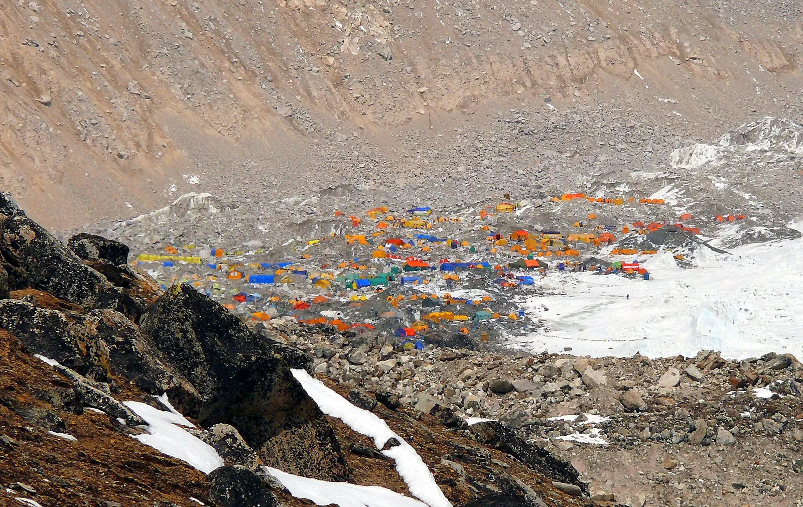
BRO's own description, carried by The Tribune and All India Radio's News On AIR on 4 and 5 October 2025, calls the road "the third vital axis from Hanle to Fukche". In plain terms: before this road, a vehicle going from Hanle to Fukche had two routes. Now it has three, and one of them crosses a ridge higher than Everest Base Camp.
The South Base Camp of Everest is at 17,598 ft (5,364 m). Mig La is about 1,800 ft (550 m) above that.
The road was built under Project Himank, the BRO formation responsible for most of eastern Ladakh. Himank was raised at Leh on 4 December 1985 and also maintains the Leh side of the Manali-Leh highway, Khardung La and the Umling La road. If you have ridden in Ladakh, you have almost certainly ridden on Himank tarmac and read its signboards.
How did the record move from Khardung La to Umling La to Mig La?
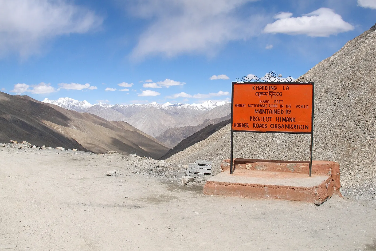
For decades the world's "highest motorable road" was a signboard claim at Khardung La, near Leh. The board said 18,380 ft (5,602 m). Measured elevation data put the pass at 17,582 ft (5,359 m), so the claim was about 800 ft (240 m) too generous. Khardung La's motorable road was built by BRO in 1976, about 40 km north of Leh.

The first record that held up to measurement came in 2017, when BRO completed the Chisumle-Umling La-Demchok road. Umling La sits at 19,024 ft (5,799 m) on the ridge between the Koyul Lungpa valley and the Indus. That beat the earlier world record holder, the mining road on Bolivia's Uturuncu volcano at 18,953 ft (5,777 m).
Guinness World Records recognised Umling La in November 2021, which is why some reports date the record to 2021 even though the road dates to 2017. As of 16 November 2026, the Guinness record page still lists Umling La as the highest altitude road; it shows no Mig La entry.
BRO says Mig La took the title in October 2025. Two things stand out:
- All three "highest road" claims in this story are BRO roads in Ladakh.
- BRO now says 11 of the world's 14 highest motorable passes were built by it, a claim it repeated with the Mig La announcement.
See the data as a table
| Altitude (ft) | |
|---|---|
| Mig La, Ladakh (5,913 m, BRO figure) | 19400 |
| Umling La, Ladakh (5,799 m) | 19024 |
| Uturuncu road, Bolivia (5,777 m) | 18953 |
| Everest South Base Camp (5,364 m, reference) | 17598 |
| Khardung La, Ladakh (5,359 m, measured) | 17582 |
| Tanglang La, Ladakh (5,328 m) | 17480 |
Source: BRO via Autocar India (Oct 2025); Wikipedia: Umling La, Khardung La, Leh-Manali Highway · Khardung La uses measured elevation, not the 18,380 ft (5,602 m) signboard figure. Everest Base Camp is a trekking camp, shown only for scale.
| Road or pass | Altitude | Built or recognised | Builder | What it connects |
|---|---|---|---|---|
| Mig La (Likaru-Mig La-Fukche) | 19,400 ft (5,913 m), BRO's figure | Announced Oct 2025; not in Guinness as of Nov 2026 | BRO, Project Himank | Hanle area to Fukche near the LAC |
| Umling La (Chisumle-Demchok) | 19,024 ft (5,799 m) | Road 2017; Guinness Nov 2021, still listed Nov 2026 | BRO, Project Himank | Chisumle to Demchok |
| Uturuncu volcano road | 18,953 ft (5,777 m) | Pre-2017 record holder | Mining road, Bolivia | Old sulphur mine on the volcano |
| Khardung La | 17,582 ft (5,359 m) (board says 18,380 ft, 5,602 m) | Road 1976 | BRO | Leh to Nubra valley |
| Tanglang La | 17,480 ft (5,328 m) | Manali-Leh highway, 1989 | BRO | Pang to Upshi on NH 3 |
Who actually builds a road at 19,400 ft (5,913 m)?
The short answer is BRO's mix of people:
- Army engineers;
- General Reserve Engineer Force (GREF) officers;
- a very large casual workforce: BRO lists more than 2 lakh casual paid labourers across its projects.
Officers rotate; the labour gangs often come back season after season.
What is, and is not, on record
BRO's announcement named only the Chief Engineer and described the work in broad strokes: extreme altitude, a hostile route, and a landscape that will draw adventure travellers. Specific figures for the crew size, the number of working days or the cost of the Mig La stretch were not published in the reports I could open, so I have left them out.
What is on record is the working environment. At Umling La, a few ridges away, winter temperatures fall to about minus 40 °C and the air carries roughly half the oxygen of sea level. Machinery behaves the same way people do up there: diesel engines lose power, hydraulic oil thickens, and the short summer window decides how much rock can be cut in a year.
The Manali-Leh highway gives a sense of the scale of that window. In 2026, BRO's Project Deepak and Project Himank needed 42 days of snow clearance, from late March to 12 May, to reconnect that one road at Sarchu, with crews retreating and restarting at least six times because of fresh snow. A new road on a ridge above 19,350 ft (5,900 m) has an even narrower season.
Why build a road this high at all?
The reason is the border. BRO's own framing puts three aims in order:
- Strategy first;
- tourism second;
- the "First Villages" programme for frontier settlements third.
A third road between Hanle and Fukche means that if one route is blocked by snow or a landslide, supplies and troops still have alternatives. Ridge roads also climb because valleys in Changthang are often wide, marshy or run the wrong way; going over the top is sometimes the shortest buildable line.
Civilian traffic gets the road second. For the villages of Hanle, Fukche and nearby hamlets, a new link cuts the distance to grazing grounds, markets and the health centre. For tourism, Ladakh's administration and BRO both expect riders to want the record selfie. The Autocar India report on the record is blunt about the conditions: services at that altitude are limited and a well-prepared vehicle is essential.
What does 19,400 ft (5,913 m) do to the human body?
At Mig La the air pressure is under half of sea level, so every breath carries under half the oxygen molecules. The standard atmosphere formula gives roughly 48 kPa at 19,400 ft (5,913 m) against 101.3 kPa at sea level. Your lungs do not get a smaller share of oxygen in the air (it is still about 21%); they get thinner air.
The fastest way to feel this is to arrive too quickly. A 2024 study in the Indian Journal of Medical Research looked at people who flew into Leh (11,500 ft, 3,500 m), which is already 7,900 ft (2,400 m) lower than Mig La.
The authors followed 1,228 Indian lowlanders who flew into Leh (11,500 ft, 3,500 m) and acclimatised there. 78 (6.4%) developed headache: 24 had high-altitude headache only, 40 had acute mountain sickness (AMS) only, and 14 had both. People arriving for the first time had about 4.5 times the odds of AMS of those returning to altitude. The limit: these were mostly fit service personnel following an acclimatisation schedule, so tourists who rush higher will likely do worse. The useful point for riders is that a headache at altitude is not always AMS, but both rise sharply with speed of ascent.
Read the paper (free)The practical rule follows from that study and from standard high-altitude advice: spend the first 48 hours in Leh doing nothing, climb in stages through Upshi, Nyoma and Hanle, and treat the top of Mig La as a visit, not a stop. Sleep lower. Headache with vomiting, breathlessness at rest or confusion is a reason to go down at once. My longer guide on altitude sickness on a motorcycle tour covers oximeter readings and the drug question in detail, and the Ladakh acclimatisation plan gives a day-by-day schedule.
What happens to a motorcycle engine at 19,400 ft (5,913 m)?
A naturally aspirated engine breathes the same thin air you do, so at Mig La it fills its cylinder with roughly half the mass of air it gets at sea level. Peak power falls roughly in line with air density.
| At altitude | Fuel-injected bike | Carburetted bike |
|---|---|---|
| Air per cylinder fill | Roughly half at Mig La | Roughly half at Mig La |
| Fuel | Adjusted to match the air | Not adjusted: runs rich |
| Side effects | Power loss only | Fouled plugs, extra power loss |
That is the mechanism behind the xBhp question in this post's forum list: riders feel the torque fade from around Rohtang and Baralacha, and it gets dramatically worse above 16,404 ft (5,000 m).
Use this to check what you just read. The calculator below estimates the air pressure and the share of sea-level power left at any altitude. It uses the standard atmosphere formula, which assumes average temperatures; on a cold morning the air is a little denser, and on a warm afternoon a little thinner.
Thin air at altitude: pressure and power left
Altitude also changes what comes out of the exhaust. That matters less for a single rider than for a valley like Hanle, which hosts an observatory precisely because its air is clean.
The team tested China VI petrol cars on real roads and in an environmental chamber at 2,297, 4,265, 6,234 and 7,874 ft (700, 1,300, 1,900 and 2,400 m) in Yunnan. Carbon monoxide per km rose with altitude and peaked at 7,874 ft (2,400 m), about 2.56 times the 2,297 ft (700 m) figure. Cold starts raised urban particle numbers by up to about 430%. The limit: these are cars, not motorcycles, and the top altitude tested is less than half of Mig La's, so the real effect at 19,400 ft (5,913 m) is unmeasured. The direction is clear, though: thinner, colder air means dirtier combustion unless the engine management compensates.
Read the paper (free)
Can a tourist ride to Mig La?
The record was set on a strategic road near the LAC, and access for civilians depends on permits issued by the Leh district administration and on Army clearance on the day.
When I checked reports up to late 2026, I found no official notice of a fixed tourist season for Mig La, so treat any tour operator's promise with caution and confirm locally in Leh before you go. Umling La, by contrast, has been ridden by tourists for several years; on 16 September 2022 teams on the Rickshaw Run even drove autorickshaws to its top.
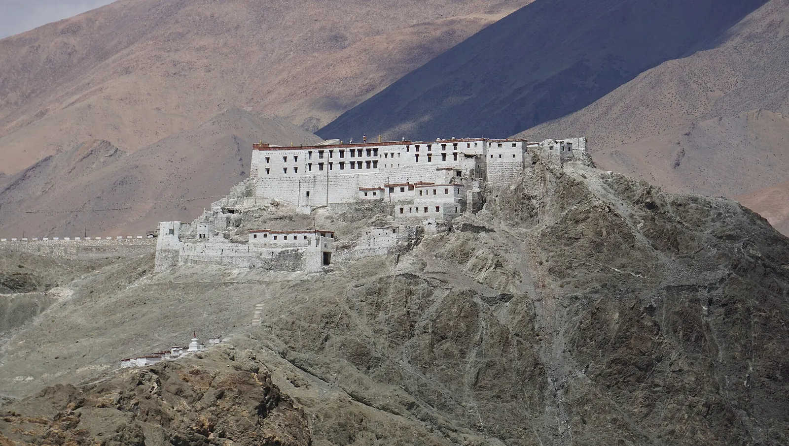
If the road is open to you, think of it as an extension of the Hanle and Umling La circuit rather than a separate trip. It is remote even by Ladakh standards, so plan fuel, water and a turnaround time before you leave Hanle. My fuel range planning guide explains how to carry enough, and the list of highest motorable passes in India shows how Mig La fits into a high-pass circuit. More Ladakh and Himalayan routes live on the Ride Atlas page.
- Acclimatise. Two nights in Leh, one in Nyoma or Hanle before attempting anything above 18,045 ft (5,500 m).
- Check the permit. Ask the Leh district administration which Inner Line Permit areas cover Hanle and Mig La for the current season.
- Carry fuel. Confirm the last pump before Hanle in Leh and carry enough for the round trip from there.
- Go early. Leave Hanle at first light so you are off the ridge before afternoon weather.
- Turn back on symptoms. The record is not worth a case of HAPE.
What does the Mig La record say about BRO?
It says BRO now treats altitude as a by-product, not a goal. Umling La and Mig La were not built to set records; they were built because border roads in eastern Ladakh had to cross those ridges, and the record followed. The pace has changed too. BRO's capital budget rose from ₹3,500 crore in 2022-23 to ₹7,146.5 crore in 2025-26, and on 7 December 2025 the Defence Minister dedicated 125 BRO projects worth about ₹5,000 crore in a single day. The full story of the organisation, from its founding in 1960 to the tunnels of the 2020s, is in my history of the Border Roads Organisation.
For riders, the lesson is simpler. The highest roads in the world are working roads first. They close without notice, they are maintained by people working in conditions most of us would not last a week in, and they are not designed for a Sunday ride.
Go slowly, go humbly, and thank the crews if you meet them.
What's new
- BRO sets the world's highest motorable road record at Mig La, 19,400 ft (5,913 m) The Tribune, Oct 2025
- Project Himank's Mig La road described as the third axis from Hanle to Fukche News On AIR, Oct 2025
- BRO says Mig La, 19,400 ft (5,913 m), replaces Umling La as the highest motorable road Autocar India, Oct 2025
- 125 BRO projects worth about ₹5,000 crore dedicated in one day, including Ladakh's Shyok tunnel Swarajya, Dec 2025
Questions people ask
Which is the highest motorable road in the world in 2026?
BRO says it is the road over Mig La in eastern Ladakh, at 19,400 ft (5,913 m), built by Project Himank and announced on 4 October 2025. Guinness World Records still lists Umling La as of 16 November 2026, so Mig La's record rests on BRO's own figure until it is independently verified.
Is Khardung La still the highest motorable pass?
No, and it never really was by the numbers. Its signboard says 18,380 ft (5,602 m), but measured elevation is 17,582 ft (5,359 m). Several Ladakh passes, including Umling La and Mig La, are far higher.
Can a 200 cc or 250 cc bike reach Mig La or Umling La?
Mechanically, yes, if it is in good health; small bikes have climbed Umling La. Expect roughly half the sea-level power at the top, so the bike will be slow on steep sections. Fuel-injected bikes cope better than carburetted ones, which run rich at altitude.
How much oxygen is there at Mig La?
The air is still about 21% oxygen, but the pressure is under half of sea level (about 48 kPa), so each breath delivers under half the oxygen. That is why acclimatisation, not fitness, decides how you feel at the top.
How far is Mig La from Leh?
The reports on the record did not publish an official road distance. Mig La is on the Hanle-Fukche side of Changthang, and Umling La, a comparable circuit, is about 230 to 250 km from Leh, an 8 to 10 hour drive. Plan Mig La as a multi-day trip from Leh with a night in Hanle.
Sources
- The Tribune: BRO constructs world's highest motorable road in Ladakh, surpasses earlier records (2025)
- News On AIR: BRO again scripts history, Project Himank constructs world's highest motorable road at Mig La (2025)
- Autocar India: Mig La pass at 19,400 ft becomes world's highest motorable road (2025)
- Vajiram and Ravi: Mig La Pass (Project Himank raised 4 December 1985) (2025)
- Wikipedia: Umling La (accessed 2026)
- Wikipedia: Khardung La (accessed 2026)
- Wikipedia: Leh-Manali Highway (accessed 2026)
- Wikipedia: Border Roads Organisation (accessed 2026)
- Unnikrishnan A. et al.: Does Lake Louise questionnaire interpret high-altitude headache as AMS? Indian Journal of Medical Research (2024)
- Wang J. et al.: RDE and dynamometer analysis of light-duty vehicle emissions across altitudes, PLOS ONE (2025)
- Engineering ToolBox: Air pressure at altitude (standard atmosphere formula)
- The Tribune: BRO reopens Manali-Leh National Highway after 42-day clear-up (2026)
- Greater Kashmir: Defence gets record ₹7.85 lakh crore (BRO capital allocation) (2026)
- Swarajya: 125 BRO projects worth ₹5,000 crore dedicated to nation (2025)

Sapta (Saptarshi Sarkar) is a mechanical engineer turned marketer in Bengaluru and a solo touring rider. He writes the seven Saptaverse blogs. Work with him or read more of RoadHook Rides.


