
A western disturbance snowfall forecast is the single most useful weather product for a Himalayan rider, because western disturbances (WDs) bring most of the off-season snow that closes Zoji La, Baralacha La and Rohtang. A typical WD travels east at about 10 to 12 m/s and soaks the western Himalaya for 2 to 3 days. So when IMD flags a WD for Jammu and Kashmir, assume Lahaul and Ladakh are hit within a day, cross your high passes before it arrives, and wait out the 48 to 72 hours instead of riding into it.
- Western disturbances bring most of the off-season snow that shuts Zoji La, Baralacha La and Rohtang.
- 8 to 10° of longitude a day: Kashmir in the morning can mean Lahaul by evening.
- 2 to 3 days of heavy precipitation per WD: wait it out, then give BRO one more morning.
- 6.5°C per 1,000 m turns a valley temperature into a freezing level for your pass.
- 0.3°C is Leh's mean October minimum, so dawn ice is normal even in dry weather.
- 42 days and six restarts: what WD snow cost BRO's 2026 Manali-Leh clearance.
Weather apps give you a cloud icon and a percentage. That is not enough at 4,800 m, where the question is not "will it rain?" but "will the pass be open tomorrow, and will the road surface freeze tonight?".
This post explains what a WD is, how fast it moves, how to read an IMD bulletin, and how to turn a valley temperature into a freezing level so you know whether that rain means snow on your pass.
What is a western disturbance?
A western disturbance is an upper-level low-pressure trough carried east by the subtropical westerly jet, which sits over the Indian subcontinent from about October to May.
When the trough meets the Himalaya, the mountains force the moist air up and wring snow out of it. In December to February, WD snowfall is the main input to the western Himalayan snowpack.
The team ran a tracking algorithm over 37 years of ERA-Interim reanalysis (1979 to 2016) and catalogued 3,090 WDs, roughly 6 to 7 a month. Composites show strong rising air ahead of the WD centre, with surface precipitation peaking under it, and cloud cover peaking at about 300 hPa roughly a day after the WD reaches peak intensity, especially near the Himalayan foothills. Years with more WDs had the jet shifted south over Eurasia, which suggests WD frequency might be forecast a season ahead if jet position can be predicted. The limit: reanalysis smooths small-scale mountain weather, so the catalogue tells you about systems, not about a single valley.
Read the paper (free)Earlier studies, summarised in the same paper, counted around 4 to 7 WDs a month in winter, and an older wave-tracking method found only 5 to 6 a year. The difference is definition: weak systems pass all the time, while the strong ones that close passes are fewer. For riders, the strong ones are what matter.
How fast does a western disturbance move, and how long does it last?
A mature WD moves at about 8 to 10 degrees of longitude a day (roughly 10 to 12 m/s) and lives 3 to 4 days, slowing when it forms and when it decays. Heavy precipitation over the western Himalaya typically persists for 2 to 3 days of that life cycle.
On 27 March 2026 the Border Roads Organisation sent two teams onto the snowed-in Manali-Leh highway: Project Deepak cutting north from Manali towards Sarchu, and Project Himank cutting south from Leh. The Manali to Sarchu stretch alone has 26 avalanche-prone points, and Baralacha La sits at about 16,040 ft (about 4,890 m), by The Tribune's figure; Wikipedia gives 4,850 m (15,910 ft). Fresh snow kept arriving. The teams had to retreat and start again at least six times, and a BRO official called that year's weather particularly harsh. They finally met at Sarchu, on the Himachal-Ladakh border, on 12 May, for what BRO calls the "Golden Handshake", after 42 days of work. Even then, vehicles were allowed on only after a joint check with the Lahaul-Spiti administration.
The Tribune: BRO reopens Manali-Leh National Highway after 42-day clear-upThis review pulls together six decades of research on WDs. Key numbers for riders: WDs travel 8 to 10° of longitude a day (10 to 12 m/s) except while forming or dissipating, with a life cycle of 3 to 4 days; heavy precipitation persists through an average 2 to 3 day cycle over the western Himalaya; and about four to six intense WDs occur in November to March. The review links landslides, avalanches and floods directly to these winter storms, and notes that WD snow in December to February sustains the snowpack whose spring melt feeds northern rivers. The limit: much of the cited work is on winter; the spring and autumn WDs that catch riders are less studied.
Read the paper (free)The arithmetic, Srinagar to Keylong
Srinagar sits at about 74.8°E and Keylong at about 77°E, a little over two degrees apart. At 8 to 10 degrees a day, the leading edge of a WD that reaches Kashmir in the morning can be over Lahaul by the same evening.
The October 2026 spell shows it. On 12 and 13 October, IMD's Shimla and Srinagar centres both forecast the same WD, with light snow on Zoji La and in the higher reaches of Lahaul-Spiti from 13 to 15 October, and dry weather back by 16 to 17 October.
One system, two states, three days.Sapta, on the October 2026 western disturbance

How do you read an IMD western disturbance bulletin?
Read an IMD bulletin for three things:
- the arrival time of the WD;
- the words describing how widespread the precipitation is;
- any named passes or districts with snow or warnings.
The regional centres (Srinagar for Jammu, Kashmir and Ladakh; Shimla for Himachal) are more useful than the national bulletin because they name places, and a pass is a place.
| Phrase in the bulletin | What it means for a rider | Action |
|---|---|---|
| "A fresh western disturbance likely to affect the western Himalayan region from [date]" | Clock starts: precipitation 2 to 3 days, starting in Kashmir | Cross the high passes at least a day before the date, or plan to wait |
| "Light snow in higher reaches", naming Zoji La or Lahaul-Spiti | Fresh snow and ice on pass roads; BRO may halt traffic | Do not start a pass crossing in the afternoon of the first day |
| "Temperatures likely to fall by 4 to 6°C" | The freezing level drops by several hundred metres | Recalculate freezing level for your pass (calculator below) |
| "Mostly dry from [date]" | The WD has passed; clearing and cold follow | Wait one more morning for BRO to clear and for black ice to melt |
| "Trekkers advised to avoid higher reaches" | Avalanche and whiteout risk | Treat as a no-go for passes above 4,000 m |
These phrases are taken from real October 2026 forecasts from the IMD centres in Srinagar and Shimla. The Shimla forecast for 13 to 15 October warned of a 4 to 6°C fall in daytime temperatures, and the Srinagar one flagged Zoji La as potentially unsafe and told travellers to confirm road status with traffic authorities first.
How do you work out whether rain in the valley means snow on the pass?
Use the freezing level: the altitude where the air drops to 0°C. With the standard atmosphere's lapse rate of 6.5°C per 1,000 m, a valley temperature of 8°C at 3,080 m (Keylong) puts the freezing level near 4,310 m.
Calculated in this post with these example inputs (8°C in the valley at Keylong, 3,080 m): 3,080 m + 8 ÷ 6.5 × 1,000 m ≈ 4,310 m. The lapse rate is the standard-atmosphere value from Wikipedia; the 8°C is an example, not a forecast.
Baralacha La at about 4,850 m (The Tribune gives 16,040 ft, about 4,890 m) is then well into the snow zone, and, with that example freezing level, any wet road above about 4,300 m will freeze after sunset.
Freezing level and pass temperature

Three adjustments matter:
- Moist air. In a WD airmass the lapse rate is lower, so the freezing level sits higher than the calculator's default suggests, but the WD also cools the valley itself, which pulls the freezing level down.
- Cold-air drainage. On clear nights after a WD, cold air drains into valleys, so valley thermometers can mislead in the early morning.
- Wind chill. Moving air cools you much faster than still air: my wind chill calculator converts a pass temperature into what you will feel at 40 km/h.
How cold does Leh get through the riding season?
Leh's mean daily minimum is above freezing only from April to October, and in October it is just 0.3°C, according to IMD normals.
That is why October rides meet frozen puddles and black ice at dawn even in dry weather, and why a single WD in late September or October can end the season.
See the data as a table
| Mean daily max (°C) | Mean daily min (°C) | |
|---|---|---|
| Jan | 1.5 | -13.1 |
| Feb | 4.2 | -9.2 |
| Mar | 9.7 | -3.7 |
| Apr | 15.3 | 1.6 |
| May | 20.0 | 6.2 |
| Jun | 24.4 | 11.3 |
| Jul | 28.5 | 15.9 |
| Aug | 28.1 | 15.1 |
| Sep | 23.4 | 9.2 |
| Oct | 16.7 | 0.3 |
| Nov | 10.6 | -7.2 |
| Dec | 4.5 | -11.7 |
Source: India Meteorological Department normals for Leh, as tabulated in Wikipedia · Leh is at about 3,500 m. Passes 1,300 to 1,800 m higher run roughly 8 to 12°C colder at the standard lapse rate.
Apply the lapse rate to Leh's numbers and the passes look harsh. Tanglang La is about 1,800 m above Leh, so at 6.5°C per 1,000 m it averages roughly 12°C colder: an October night there is far below freezing even in a normal year. My post on riding Ladakh in October covers what that means for the late season.
When do the high passes open and close?
The Manali-Leh road usually reconnects in late April to mid-May and closes between late October and November, depending on the year's snow. Exact dates swing by weeks, which is why riders should watch the forecast, not the calendar.
| Year | Manali-Leh reconnected by BRO | Open to tourists | Winter closure |
|---|---|---|---|
| 2024 | 23 April | Late April | n/a |
| 2025 | 13 May | Late May | 20 November |
| 2026 | 12 May (after 42 days of clearance from 27 March) | 1 June | No official order found as of 15 October |

The 2026 clearance told in the story above shows how WDs drive the calendar: BRO's Project Deepak (Manali to Sarchu) and Project Himank (Sarchu to Leh) began on 27 March, had to retreat and restart at least six times because of fresh snow, and met at Sarchu on 12 May.
On the Srinagar side, a late-March WD shut the Srinagar-Leh highway on 29 March 2026 after snow on the Sonamarg-Zojila axis.
What is a rider's decision plan when a WD is forecast?
The plan is simple: get across before, sit out during, wait a morning after. In practice that means checking forecasts for five days ahead from the moment you leave the plains.
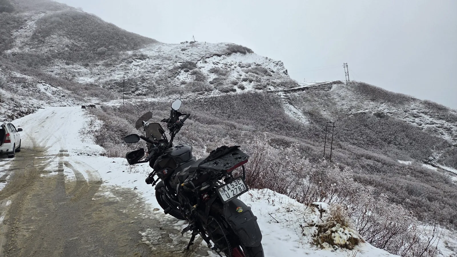
- Five days out: read the IMD Srinagar and Shimla district forecasts every evening. Note any "fresh western disturbance" with a start date.
- Two days out: decide which side of the passes you want to be on when it arrives. A night at Jispa or Kargil, below the big passes, is a good place to wait.
- Day of arrival: cross passes only in the morning, before the precipitation reaches you. If the WD is already over Kashmir, assume Lahaul by evening.
- During: stay put for the 2 to 3 days of the spell. Use the time for acclimatisation and maintenance.
- After: wait for BRO and the district administration (Lahaul-Spiti police, Leh and Kargil traffic control) to confirm the road is open, then start mid-morning once the sun has worked on the ice.
Landslides follow WD rain on lower slopes too; my explainer on why Himalayan roads collapse covers that side. If a WD has left the pass roads under slush and ice, read my technique post on slush and black ice before you set off.
What's new
- MeT Srinagar forecasts light snow on Zoji La and other passes from a fresh WD, 13 to 15 October NewKerala (IANS), Oct 2026
- IMD Shimla: WD to bring snow to Lahaul-Spiti and a 4 to 6°C temperature drop NewKerala (IANS), Oct 2026
- BRO reopens the Manali-Leh highway after a 42-day snow-clearance operation The Tribune, May 2026
- Fresh snowfall shuts the Srinagar-Leh highway and the Bandipora-Gurez road All India Radio News, Mar 2026
Questions people ask
When does the Manali-Leh highway close for winter?
Usually between late October and November, when snow shuts the road beyond Zing Zing Bar toward Baralacha La and Sarchu. In 2025 it closed on 20 November. The trigger is almost always a western disturbance, so watch IMD forecasts from October.
Is it risky to ride to Ladakh in late May?
The roads are often just reopening, with snow walls, slush and water crossings near Baralacha La. In 2026, BRO reconnected Manali-Leh on 12 May and full tourist traffic resumed on 1 June. Srinagar-Leh usually opens earlier, but late WDs can still shut Zoji La.
How long does a western disturbance last?
A typical WD has a 3 to 4 day life cycle and brings 2 to 3 days of heavy precipitation over the western Himalaya. Plan to wait out a spell rather than ride through it.
Which weather forecast is best for Himalayan passes?
The IMD regional forecasts from Srinagar and Shimla, read alongside a freezing-level estimate. They name passes and districts, which global apps rarely do.
Sources
- Hunt KMR, Turner AG, Shaffrey LC: The evolution, seasonality and impacts of western disturbances, QJRMS (2018)
- Dimri AP et al.: Western Disturbances, a review, Reviews of Geophysics (2015)
- The Tribune: BRO reopens Manali-Leh National Highway after 42-day clear-up (2026)
- Discover with Dheeraj: Manali Leh Highway status 2026, with past opening and closing dates (2026)
- NewKerala: J&K forecast, snowfall in higher reaches (2026)
- NewKerala: Western disturbance to bring rain and snow to Himachal (2026)
- All India Radio News: Fresh snowfall shuts Srinagar-Leh highway (2026)
- Leh climate table, IMD normals
- Srinagar-Leh Highway: Zoji La and Fotu La altitudes
- Leh-Manali Highway: pass altitudes and season

Sapta (Saptarshi Sarkar) is a mechanical engineer turned marketer in Bengaluru and a solo touring rider. He writes the seven Saptaverse blogs. Work with him or read more of RoadHook Rides.


