
A river and a highway bend for the same reason: each has a gradient it can live with, and when the ground falls more steeply than that, the only way to keep the gradient down is to make the path longer. One line of geometry covers both, path slope = ground slope ÷ sinuosity. Where they differ is in shape: a river spreads its extra length into smooth, sine-generated loops with a sinuosity of about 1.1 to 2, while a ghat road on a 30° hillside needs a sinuosity near 12 and has to fold it into hairpins.
- S = Sv / k: path slope equals ground slope divided by sinuosity, for a river and a road alike.
- 5% is the ruling gradient for Indian mountain roads under IRC:52-2019, so every 1,000 m of climb costs about 20 km of road.
- A road on a 30° hillside needs a sinuosity near 12, about 19 hairpins per 1,000 m; free river meanders sit near 1.1 to 2.
- Both refuse a sudden change in curvature: the river through the sine-generated curve, the road through 15 m transitions.
- Ganges bends near Farakka cut off after about 31 to 35 years; a road's version of the cutoff is the tunnel or viaduct bypass.
Ride up the Valparai ghat and look down at the Aliyar reservoir from the 14th hairpin, or stand at the top of the Gata Loops on the Manali–Leh road and watch the Tsarap river below, and you see two paths that refuse to go straight.
This post proves the link properly: the river side from the 1966 USGS theory of meanders and a 2017 study of Ganges bends near Farakka, the road side from India's hill road code, IRC:52-2019. Then it tests where the comparison breaks.
What does "the same way" actually mean?
It means both are solving one constraint: drop a fixed height between two points without exceeding a target slope. Sinuosity, k, is path length divided by straight-line length, and it is the single number that connects the two.
- The drop: a fixed height, Δz, between two fixed end points.
- The target: a slope the path can live with, set by flow for a river and by code for a road.
- The fix: when the ground is steeper than the target, make the path longer, which raises k.
The river's target slope floats
For a river, the target slope is not a rule written down anywhere. Walter Langbein and Luna Leopold of the US Geological Survey argued in 1966 that a river's slope is an adjustable quantity, set together with depth, velocity and width by the discharge and sediment the basin delivers. If the valley falls faster than that, the river lengthens itself.
The road's target slope is written down
For a road, the target is fixed by code. IRC:52-2019 gives a ruling gradient of 5% (1 in 20) for mountainous terrain and for steep terrain above 3,000 m, with 6% as the limiting gradient for short stretches and 7% as the exceptional gradient for no more than 100 m at a time.

Why do rivers meander at all?
Rivers meander because a small bend grows: flow around a curve sets up a spiral current that scours the outer bank and drops sediment on the inner one. Einstein explained this secondary flow in a two-page paper in Die Naturwissenschaften in March 1926, using the tea leaves that gather in the middle of a stirred cup; James Thomson had described the same mechanism in 1857.
In Life on the Mississippi (1883), Mark Twain, a former Mississippi pilot, described how the river carves deep horseshoe bends and then, at high water, breaks through the narrow neck of one, sometimes helped by a landowner's ditch. Once the water gets through, he wrote, it cuts the banks away like a knife, and the old loop is left behind to silt up.
He listed the jumps. The Port Hudson neck cut-off of 1722 shortened the river by 35 miles; Raccourci took out 28; American Bend, which his own boat failed to get through on its first try, ten or more. By his count the Cairo to New Orleans course had lost 242 miles in 176 years, from 1,215 miles to about 973. Then he mocked anyone who would extend the trend: in 742 years, he said, the Lower Mississippi would be a mile and three-quarters long, and Cairo and New Orleans would share one mayor. He was joking about the maths, not about the cut-offs.
Mark Twain: Life on the Mississippi, chapter 17, "Cut-offs and Stephen" (Project Gutenberg)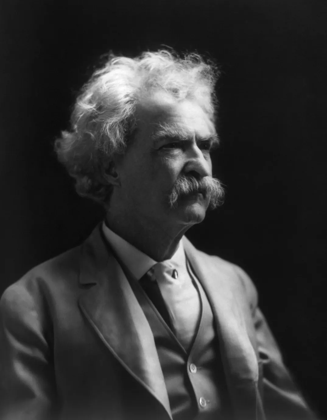
The bend shape itself comes from statistics. Langbein and Leopold treated the many small causes of deviation as random and asked which path between two points, of a fixed length, is the most probable. The answer, from H. von Schelling's random-walk work, is the path that minimises the sum of the squared changes in direction per unit length. They called it the sine-generated curve: the direction, not the position, is a sine wave along the channel.
The authors model a meander as the most probable random walk of fixed length between two points, derive the sine-generated curve, and test it against surveyed channels and field measurements of depth, velocity and slope collected during snowmelt floods from 1959 to 1964. Among four curves with the same wavelength and sinuosity, the sine-generated curve had the lowest sum of squared direction changes (3,940 against 4,840 for circular arcs and 5,200 for a plain sine curve). It predicts a meander-length-to-bend-radius ratio of 4.2 to 5.0; 50 measured river samples averaged 4.7. Limit: it describes regular, free meanders well, but real rivers carry noise from rock outcrops, varying flow and even trees.
Read the paper (free)
How do you solve both with one equation?
The working below states the assumptions, derives the shared identity, then pushes real road-code numbers through it. Every step is ordinary geometry; the inputs are from IRC:52-2019 and the USGS paper.
Assumptions. The river reach and the road both drop a height Δz between fixed end points. The river has a preferred slope Sc set by its flow and sediment; the road has a target gradient g measured, as Indian codes do, as rise over horizontal distance. The hillside has a uniform slope angle β. Small-slope geometry applies (the error is under 0.2% at 5%).
Calculated in this post from the IRC:52-2019 ruling gradient of 5%: the angle is arctan 0.05 = 2.86°, and cos 2.86° = 0.9988, so the error is about 0.12%.
- Define sinuosity. Valley length Lv, channel length Lc, the same drop Δz:
\[ S_v = \frac{\Delta z}{L_v},\qquad S_c = \frac{\Delta z}{L_c},\qquad k = \frac{L_c}{L_v} \;\Rightarrow\; S_c = \frac{S_v}{k} \]
- Write the same identity for a road. The fall line of the hillside has slope tan β, the road has slope g:
\[ L_{road} = \frac{\Delta h}{g},\qquad L_{fall} = \frac{\Delta h}{\tan\beta} \;\Rightarrow\; k_{road} = \frac{\tan\beta}{g} \]
- Plug in a real climb. A 1,000 m climb on a 30° hillside at the 5% ruling gradient:
\[ k_{road} = \frac{0.577}{0.05} = 11.5,\qquad L_{road} = \frac{1000}{0.05} = 20\ \text{km},\qquad L_{fall} = \frac{1000}{0.577} = 1.73\ \text{km} \]
Calculated in this post from the IRC:52-2019 ruling gradient of 5% and a 30° hillside with a 1,000 m climb, both chosen as the example: tan 30° = 0.577.
- Fold it onto a hill face. If the usable face is W = 1 km wide, the road must run n legs across it, with n − 1 hairpins:
\[ n = \left\lceil \frac{L_{road}}{W} \right\rceil = 20 \;\Rightarrow\; 19\ \text{hairpins} \]
- Charge for the hairpins. IRC:52-2019 caps the gradient through a hairpin at 2.5% with a 14 m inner radius. For a 9 m single-lane apex the centreline radius is about 18.5 m, so each turn is πr ≈ 58 m long and climbs 1.45 m instead of the 2.9 m it would at 5%. The lost 1.45 m must be made up on a leg:
\[ \Delta L = 19 \times \frac{1.45}{0.05} \approx 0.55\ \text{km} \;\Rightarrow\; L_{road} \approx 20.6\ \text{km},\ k \approx 11.9 \]
Calculated in this post from the same IRC:52-2019 hairpin limits (clause 6.10) and an assumed 9 m wide apex: radius 14 + 4.5 = 18.5 m, π × 18.5 ≈ 58 m, 58 × 2.5% ≈ 1.45 m, 58 × 5% ≈ 2.9 m.
- Write the river's shape. Langbein and Leopold's sine-generated curve, with maximum angle ω to the valley axis and meander path length M:
\[ \phi(s) = \omega \sin\!\left(\frac{2\pi s}{M}\right),\qquad k = \frac{1}{\langle\cos\phi\rangle} \approx \frac{4.84}{4.84 - \omega^2} \]For ω = 1.0 rad (57°) the fit gives k ≈ 1.26 against their computed 1.30; for ω = 1.5 rad it gives 1.87 against 1.96. The formula blows up at ω ≈ 2.2 rad (126°), which matches the 125° the paper gives for a gooseneck loop on the point of crossing itself.
See the data as a table
| Sinuosity k | |
|---|---|
| 0.5 rad (29 deg) | 1.06 |
| 1.0 rad (57 deg) | 1.3 |
| 1.5 rad (86 deg) | 1.96 |
| 1.75 rad (100 deg) | 2.67 |
Source: Langbein and Leopold, USGS Professional Paper 422-H (1966), values computed at 24 points per wavelength · A road on a 30 degree hillside at 5% needs k of about 12, far off this chart.
Do rivers and roads smooth their curves the same way?
Yes, and this is the deeper half of the link: neither likes a sudden change in curvature. In the sine-generated curve, curvature is the rate of change of direction, dφ/ds = ω(2π/M) cos(2πs/M), so it rises and falls smoothly and never jumps.
The road engineer's version
A road engineer reaches the same place from a different penalty. A sudden step from straight to circular would demand an instant step in lateral acceleration and steering angle, so IRC:52-2019 asks for a hairpin to be one of two shapes:
- a circular curve with a transition at each end, or
- a compound curve,
with at least 15 m of transition. In a transition curve the curvature grows steadily with distance, which is the road version of the river refusing to change direction abruptly.
The river minimises the variance of its direction changes; the road designer minimises the rate at which a rider's lean angle has to change.
How sensitive is the answer to the hillside and the gradient?
Very: required sinuosity scales directly with the steepness of the hill and inversely with the gradient you allow. Halving the gradient doubles the road, which is the whole trade.
| Hillside slope | tan β | k at 5% (ruling) | k at 7% (exceptional) | Road per 1,000 m climb at 5% |
|---|---|---|---|---|
| 10° | 0.176 | 3.5 | 2.5 | 20 km |
| 20° | 0.364 | 7.3 | 5.2 | 20 km |
| 30° | 0.577 | 11.5 | 8.2 | 20 km |
| 40° | 0.839 | 16.8 | 12.0 | 20 km |
Notice the last column never changes. The road length to gain a given height depends only on the gradient; the hillside slope decides how tightly that length must be folded, which is to say how many hairpins you ride.
Below a hillside slope of about 2.9° (tan β = 0.05) no bending is needed at all, and the road can run straight. Rivers have the same threshold: where the valley is already as gentle as the channel wants, sinuosity sits near 1.
See the data as a table
| Road length (km) | |
|---|---|
| Hairpin maximum 2.5% | 40 |
| Ruling, mountainous 5% | 20 |
| Ruling, steep below 3000 m 6% | 16.7 |
| Exceptional, mountainous 7% | 14.3 |
| Exceptional, steep 8% | 12.5 |
Use this to check what you just read, or to estimate a climb on your next ride.
How long and how folded must a hill road be?
What does the Ganges show about the limit?
A meandering river cannot lengthen forever: past a critical bend tightness it cuts through the neck of the loop and snaps back to a lower sinuosity. Peter Carling and colleagues documented this on four Ganges bends near the Farakka Barrage, a slope so gentle that the bankfull energy gradient is only about 5 to 6 cm per kilometre.
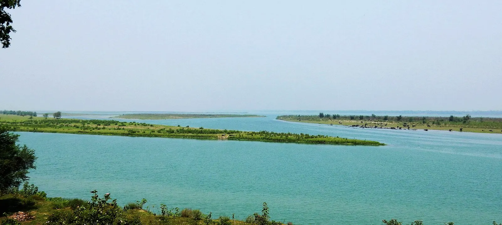
Using eleven historical maps from 1780 to 1967 and 38 years of Landsat and Indian Remote Sensing imagery from 1972, the authors tracked four similar bends, one upstream and three downstream of the Farakka Barrage. All four cut off, or tried to, after about 31 to 35 years. Cutoffs came when the bend radius had tightened to between 5,000 and 2,000 m, and a radius-to-width ratio of about 1.29 marked the critical state. Sinuosity grows, the bend becomes unstable, a cutoff resets it, and growth begins again. Limit: four bends give replicates, not a statistical cutoff frequency.
Read the paper (free)The road's cutoff: the bypass
Roads have the mirror image of the cutoff: the bypass. When traffic outgrows a ghat, engineers cut through the loops with a tunnel or a viaduct, just as the river cuts a neck. The difference is that the road cutoff usually keeps the gradient gentle by adding structure rather than dropping height.
NHAI's Thoppur ghat realignment on NH 44 replaces a 5 to 7% descent with about 3% across 6.6 km, 3.68 km of it elevated on 83 piers. At 3%, 6.6 km of road can drop only about 200 m; at 6% the same drop takes 3.3 km.
Calculated in this post from the 6.6 km length and 3% gradient: 6,600 m × 0.03 ≈ 200 m, and 200 m ÷ 0.06 ≈ 3.3 km.
Where does the comparison break?
It breaks on shape, cause and scale, and the honest version of the title is "bend for the same reason, not in the same shape".
| Property | Meandering river | Ghat road |
|---|---|---|
| Typical ground slope | About 0.00005 (Ganges near Farakka) | 0.18 to 0.84 (10° to 40° hillsides) |
| Target slope | Floats with discharge and sediment | Fixed by code: 5% ruling in hills |
| Typical sinuosity | About 1.1 to 2.0 in Leopold and Wolman's 50 samples | 3 to 17 on hillsides |
| Bend shape | Smooth sine-generated loops | Straight legs and hairpins, at least 60 m apart |
| Who decides | Erosion and deposition, statistically | An engineer minimising transport cost |
| Reset mechanism | Neck cutoff, about 31 to 35 years on the Ganges bends | Tunnel or viaduct bypass |
Opposite ends of one rule
The biggest break is the regime. Rivers meander on nearly flat ground; on steep ground they cut straight down and form gorges, which is exactly where roads are forced to zigzag.
A road beside a mountain river therefore usually bends more than the river does: at the Gata Loops, the road climbs away from the Tsarap in 21 hairpins while the river keeps to its valley floor. The two paths obey one rule and sit at opposite ends of it.


Hikers obey the same rule without a code. Marcos Llobera and Tim Sluckin's 2007 model in the Journal of Theoretical Biology found a critical slope above which walking straight up costs more energy than angling across, so a walker zigzags. That is why old mule tracks and the roads built over them, like the history in the Manali–Leh highway's story and the Bhor Ghat's, already looked like switchbacks before any engineer drew them.
India's hill road code sets the gradients used above: 5% ruling, 6% limiting and 7% exceptional for mountainous terrain (6, 7 and 8% for steep terrain below 3,000 m), with exceptional stretches no longer than 100 m and at least 100 m of gentler road between them, and no more than 100 m of cumulative rise in any 2 km of mountainous road. Hairpins get a 20 km/h design speed, a 14 m inner radius, 15 m transitions, a 2.5% maximum gradient, 10% superelevation and 60 m between successive bends. It also tells surveyors to assume a gradient about 20% flatter than ruling (4% for a 5% road) when estimating how far a route must travel between two heights. Limit: these are design targets for new roads; many older ghats pre-date them.
Read the standard (free)A river and a highway bend for exactly the same reason: both obey path slope = ground slope ÷ sinuosity, and both stretch their path until the slope reaches what they can tolerate. Both also avoid sudden changes in curvature. They do not bend in the same shape: a river's target slope floats and its sinuosity sits near 1.1 to 2 in smooth loops, while a road on a 30° hillside held to IRC's 5% needs a sinuosity near 12, delivered in about 19 hairpins per 1,000 m of climb.
For more Ride Atlas reading, start at Yatri.
What's new
- Tibetan Plateau rivers on thawing permafrost are migrating about 35% faster than in 1987 Geophysical Research Letters, Jan 2025
- One tube of the six-lane Khambatki ghat tunnel on NH 48 opens for trials, bypassing a curve-heavy ghat Swarajya, Apr 2026
- Thoppur ghat realignment on NH 44 reaches about 46%, cutting the descent from 5–7% to about 3% DT Next, Jul 2026
What if next?
- Migrating birds and long-distance riders make the same fuel decision: carry more fuel and burn more to carry it, or stop more often.
- A dabbawala's route is better than your navigation app: the relay that beats software at its own game.
- The monsoon is a heat engine, and so is your motorcycle: one cycle, a billion times apart in scale.
Questions people ask
Why do rivers curve back and forth instead of flowing straight?
A small bend grows because flow round a curve sets up a spiral current that erodes the outer bank and deposits on the inner one, the effect Einstein explained in 1926. The loops take the sine-generated shape because it is the statistically most probable path of a given length, as Langbein and Leopold showed in 1966.
Why don't mountain roads go straight up?
Because vehicles cannot safely climb or brake on the slopes of most hillsides. IRC:52-2019 sets 5% as the ruling gradient in mountainous terrain, so climbing 1,000 m takes about 20 km of road whatever the hill looks like; on a 30° slope that is about 11.5 times the straight-up distance.
What is the steepest gradient allowed on an Indian hill road?
For new roads, IRC:52-2019 allows 7% in mountainous terrain and 8% in steep terrain below 3,000 m, but only as exceptional gradients for up to 100 m at a stretch. Through a hairpin bend the maximum is 2.5%.
Why do rivers form oxbow lakes?
When a loop grows tight enough, a flood cuts across its narrow neck and the river abandons the loop, which becomes an oxbow lake. On four Ganges bends near Farakka this happened, or was attempted, after about 31 to 35 years.
Sources
- Langbein and Leopold, USGS Professional Paper 422-H: River meanders, theory of minimum variance (1966) (source for the sine-generated curve, the sinuosity values, the 4.7 length-to-radius ratio and the 125° gooseneck angle)
- Carling et al., Geology: Criticality in the planform behavior of the Ganges River meanders (2017) (source for Farakka bends, 31 to 35 year cutoffs, energy slope and critical radius)
- Indian Roads Congress, IRC:52-2019 Guidelines for the alignment survey and geometric design of hill roads (2019) (source for all gradients, hairpin geometry and transitions)
- Wikipedia: Tea leaf paradox (accessed 2026) (source for Einstein's 1926 paper in Die Naturwissenschaften and Thomson's 1857 explanation)
- University of Washington News: In the race to the top, zigzagging is more efficient than a straight line (2008) (source for Llobera and Sluckin's critical-slope model)
- Mark Twain: Life on the Mississippi, chapter 17, "Cut-offs and Stephen" (Project Gutenberg) (1883) (source for the story: the Port Hudson, Raccourci and American Bend cut-offs and the 242 miles in 176 years)
- Sha et al., Geophysical Research Letters: Accelerated river meander migration on the Tibetan Plateau caused by permafrost thaw (2025) (source for the 34.6% rise in migration rates)
- DT Next: Thoppur ghat realignment on National Highway 44 gathers pace (2026) (source for the 6.6 km, 3% gradient and 83 piers)
- Swarajya: Six-lane Khambatki ghat tunnel opens for trial run (2026)

Sapta (Saptarshi Sarkar) is a mechanical engineer turned marketer in Bengaluru and a solo touring rider. He writes the seven Saptaverse blogs. Work with him or read more of RoadHook Rides.


