
Riding Solo to the Top of the World is a 94-minute documentary, released on 1 November 2006, in which Mumbai filmmaker Gaurav Jani rode a 350 cc Royal Enfield Bullet alone from Mumbai to the Changthang plateau of eastern Ladakh and filmed the whole journey himself, with no crew and no back-up vehicle. The trip took about 50 days and produced 40 hours of footage. It won the Golden Conch for best Indian documentary at the Mumbai International Film Festival and became a reference film for Indian riders who wanted to tour alone.
- 94 minutes of film, cut from 40 hours of tape, released on 1 November 2006.
- About 50 days on a Royal Enfield Bullet 350 he called Loner, with no crew and no back-up.
- About 4,450 m: the typical height of Changthang, where he lived with a Changpa herding family.
- ₹18 lakh, borrowed from family and friends, was his reported spend on the film by November 2006.
- Golden Conch for best Indian documentary at the Mumbai International Film Festival.
Plenty of Indian riders had been to Ladakh before 2006. What Jani did differently was go past the usual circuit of Leh, Khardung La and Pangong, into the high nomad country along the Chinese border, stay with a Changpa herding family, and bring back a film that was about the people as much as the bike.
Below is what the record says about the film and the man, where the accounts disagree, and what Changthang is like for a rider today, now that it is its own district.
Who is Gaurav Jani?
Gaurav Jani is a Mumbai documentary filmmaker and motorcyclist. Before his own films he worked as:
- a fashion designer in Ahmedabad;
- an assistant director on Ram Gopal Varma's film Jungle (2000).
He learned camera work on the job while shooting his first documentary, and he is a founder member of 60kph, a motorcycle travel club in India, according to a 2013 profile in The Tribune.
Near Datta, at about 16,000 ft on the Changthang plateau, Jani lost his way as darkness fell. The most valuable thing he carried was his exposed tape, so instead of searching for the route in the dark he chose to protect it. He pitched his tent in sub-zero cold and zipped it shut.
In the thin air, with almost no ventilation, he was breathing back his own exhaled air, and he spent a restless night. He woke with a headache. In the morning he found a group of Changpa tents some distance away, and with them, a way out of danger.
Shevlin Sebastian, Hindustan Times (reproduced): Vroooom to the top of the world (2006)No sponsors, borrowed money
His production company, Dirt Track Productions, made Riding Solo to the Top of the World with no sponsors. A Hindustan Times report from November 2006 said he had spent ₹18 lakh on it, borrowed from family and friends, and had recovered about a quarter of that by then.
He has since made One Crazy Ride, a group journey with four friends, and Motorcycle Chang Pa, a film about a year with the Changpa nomads.

How did Jani film a solo ride with no crew?
He did every job himself. For each riding shot, the Hindustan Times account describes the routine:
- Set up. Unpack the camera and fix it on a tripod.
- Frame and ride. Put on the helmet and ride through the frame.
- Check. Walk back to the camera and review the shot.
- Pack and go. Repack the tripod and gear, and ride on.
The credits and the camera
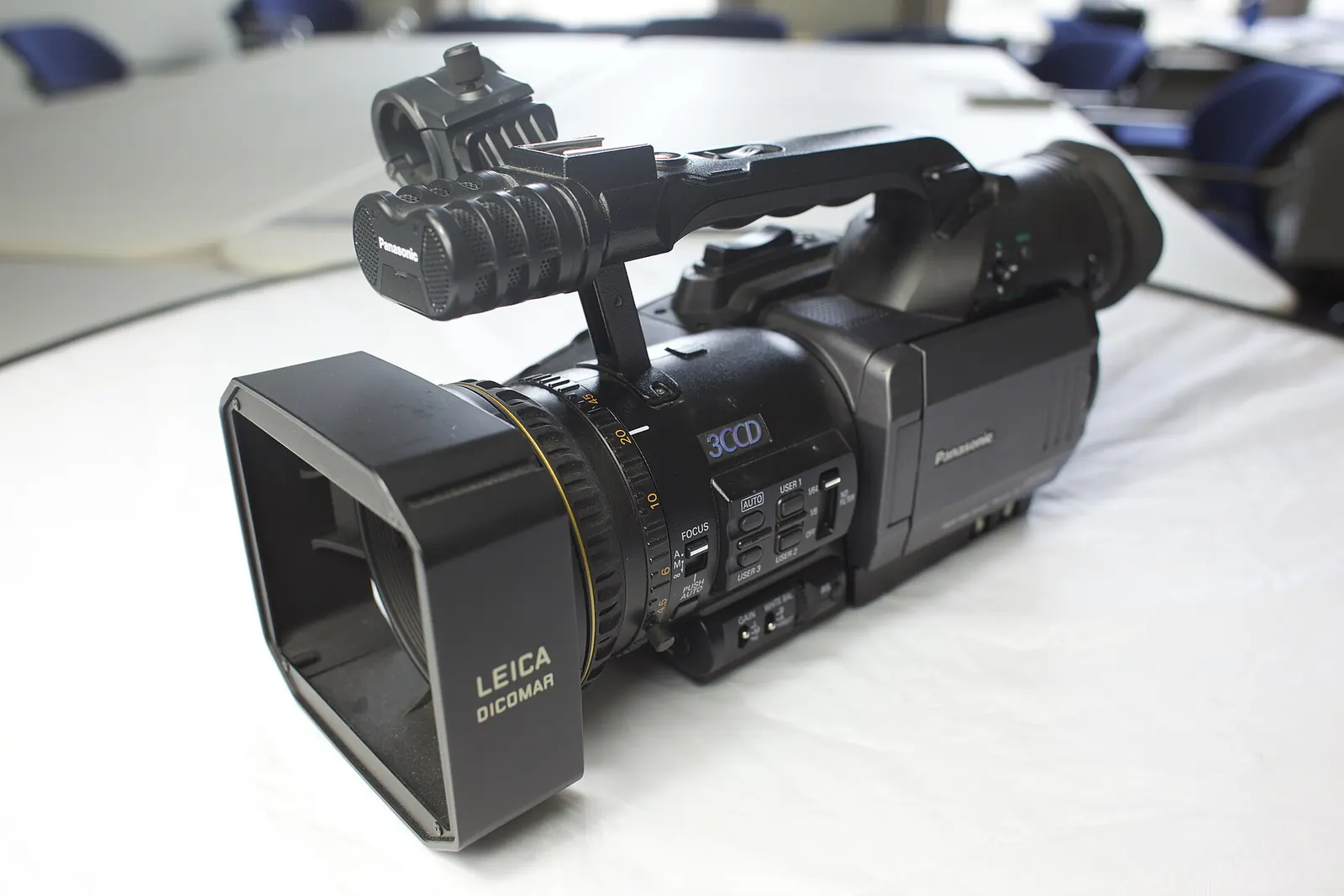
The Wikipedia entry credits him as director and cinematographer, with Sankalp Meshram as editor and Ved Nair as composer. The camera was a Panasonic DVX-100, a Mini DV model, which he told an interviewer in 2011 he used for both of his first two films.
The route
The 2006 report gives the route: he took the train with his bike from Mumbai to Jaipur, then rode National Highway 1 north towards Ladakh, and spent 50 days on the trip.
That means every shot of him on the road cost him the same stretch of road three times: once to set up, once on camera, once to collect the gear. Anyone who has tried to film their own ride knows how much patience that takes at 4,000 m.
| Detail | What the sources say | Source |
|---|---|---|
| Bike | Royal Enfield Bullet 350, which he named Loner | Wikipedia; MotoJournalism interview, 2011 |
| Load | About 300 kg of equipment | Hindustan Times, 2006; Wikipedia |
| Load (other account) | About 220 lb of gear plus 9 gallons of fuel, ~560-mile range | Motorcyclist magazine, 2009 |
| Route length | About 3,100 miles, Mumbai to Changthang | Motorcyclist, 2009 |
| Altitude | Average about 15,000 ft; about 16,000 ft near Datta | Motorcyclist; Hindustan Times |
| Footage | 40 hours, cut to 94 minutes | Hindustan Times |
| Release | 1 November 2006 | Wikipedia |

Two load figures that do not agree
The two load figures are far apart, and 300 kg of luggage on a 350 cc Bullet sounds implausible next to a total of about 100 kg of gear in the American review. The 300 kg figure may include the motorcycle or be a reporting slip; no source explains it, so I give both.
What all accounts agree on is that the bike was badly overloaded for its 18 or so horsepower, and that at the highest points he had to push it.
What did Jani find in Changthang?
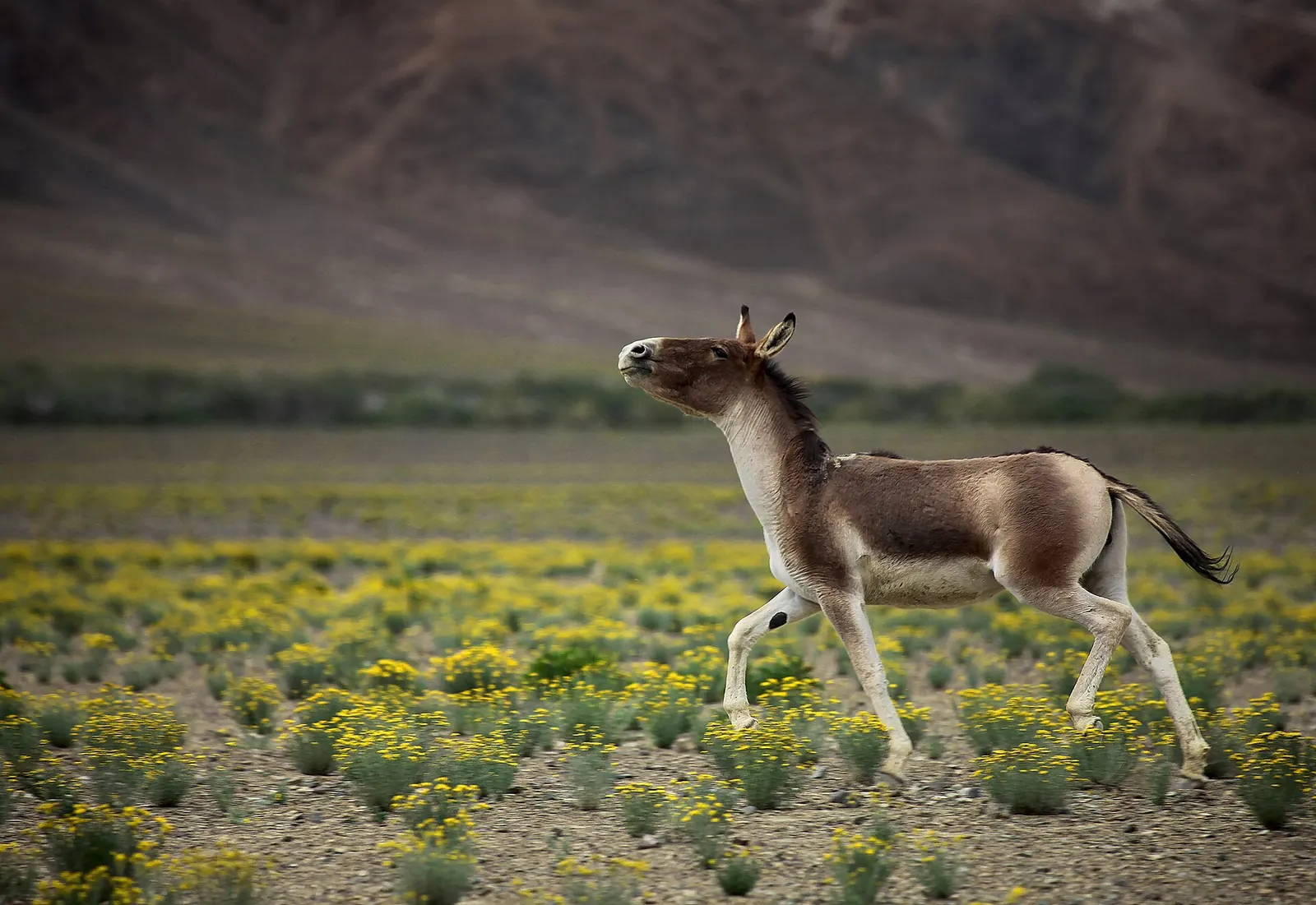
He found the Changpa, the herding people of the plateau, and stayed with a herder named Tsewang and his family, eating with them and filming their daily life.
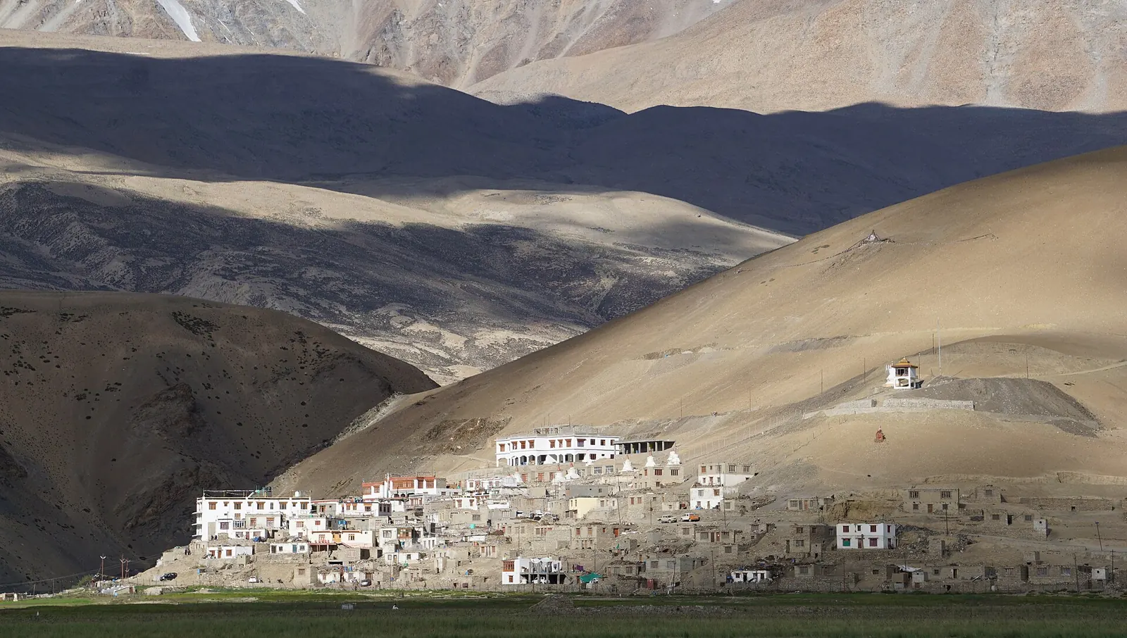
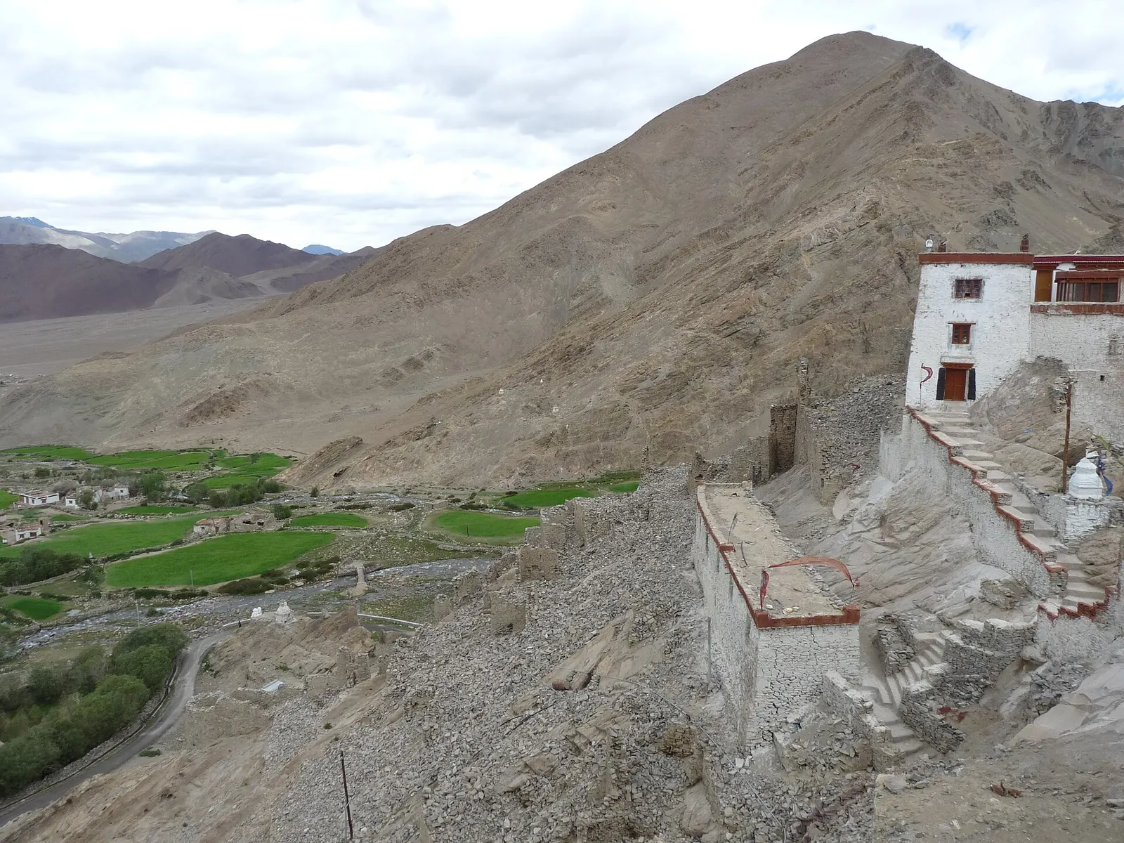
He also filmed at the monastery of Chumur, which the 2006 report describes as 350 km from Leh and 8 km from the Chinese border, in a village of about 50 families; he was reported to be the only outsider allowed to film there. Inside, he recorded an embalmed monk and other relics that the report says National Geographic had not been permitted to see.
The frightening night, read as medicine
The night near Datta, told in the box above, is a textbook altitude story: poor sleep and a headache at high altitude in a sealed tent are warning signs, not just discomfort. The Ladakh acclimatisation plan explains why.
The classic field study of Changtang herders, on the Tibetan side of the same plateau. The authors spent 16 months in western Tibet between June 1986 and June 1988, ten of them living with one community, Pala, of about 265 people in 57 households in camps at 16,000 to 17,500 ft. They describe a pastoral economy of yak, sheep, goats and horses with no crops, December nights of minus 15 to minus 30°F, and air pressure at 5,000 m of about 422 torr against 760 at sea level. It is the best open background to the life Jani filmed on the Indian side. The limit: it covers Tibet in the 1980s, where history and policy differ from Ladakh's.
Read the book (free PDF)What is Changthang, and how high is it?
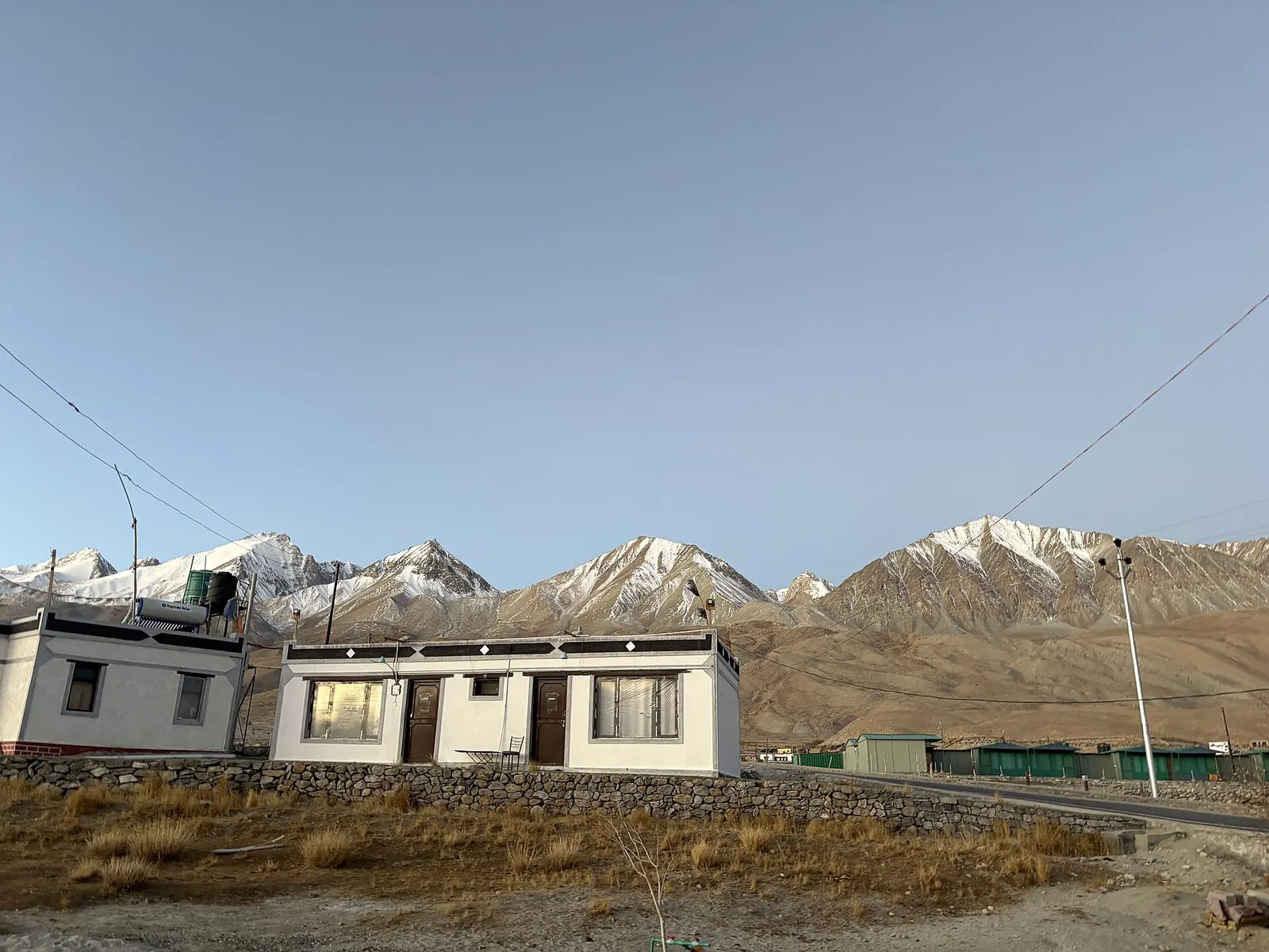
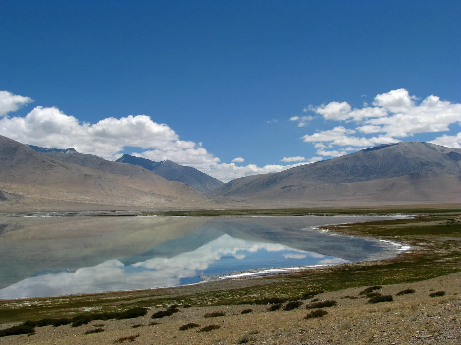
Changthang is the high, cold plateau of south-eastern Ladakh along the border with Tibet, typically about 4,450 m above sea level, where Changpa herders move yak, sheep and pashmina goats between grazing grounds.
It holds Pangong Tso (4,267 m), Tso Moriri (about 4,270 m) and Tso Kar, and the Indian Astronomical Observatory at Hanle (4,500 m).
How cold
The Tribune's 2013 profile of Jani describes winds of about 70 km/h and winter temperatures below minus 15°C; in his 2011 interview, Jani said he had recorded minus 37°C while filming his second film there.
See the data as a table
| Elevation (m) (m) | |
|---|---|
| Hanle observatory (57% of sea-level pressure) | 4500 |
| Changthang, typical (57%) | 4450 |
| Tso Moriri (59%) | 4270 |
| Pangong Tso (59%) | 4267 |
Source: Elevations from Wikipedia (Changthang district); pressure calculated with the NASA Glenn standard-atmosphere model · Tso Moriri is given as about 14,000 ft. Real pressure varies a few percent with weather.
The Changpa today
The Changpa are a small community in India. Wikipedia, citing the 2011 Census tribal tables, gives 2,661 people recorded as Changpa, while the district as a whole had about 13,000 residents in 2011, mostly nomadic and semi-nomadic herders.
The historic migration routes into Tibet closed after China took control there, and The Tribune noted by 2013 that many families were moving into permanent houses as dirt tracks were paved.
| Place in Changthang | Height | Note |
|---|---|---|
| Pangong Tso | 4,267 m | About 40 miles long; India holds about a third |
| Tso Moriri | About 4,270 m (14,000 ft) | Near Karzok, about 240 km from Leh |
| Tso Kar | Not stated in source | About 76 km from Tso Moriri; Ramsar site since 2020 |
| Hanle (Indian Astronomical Observatory) | 4,500 m | Run by the Indian Institute of Astrophysics |
| Chumur | Not stated in source | About 350 km from Leh, 8 km from the border, per the 2006 report |

Why did Riding Solo to the Top of the World shape Indian touring culture?
Because it showed that an ordinary Indian rider on an ordinary Indian bike, with no sponsor, could go to the far edge of the country alone and come back with a story worth watching.
The awards and the reach
- Golden Conch for best documentary (Indian section) and the National Critics award at the Mumbai International Film Festival.
- Best documentary at the Signs festival of the Federation of Film Societies of India.
- Discovery Channel bought its Indian television rights, according to the 2006 report.
- An American magazine reviewing it in 2009 contrasted its bare-bones honesty with the big-budget Long Way Down.
The bike mattered too
Jani told his 2011 interviewer that in India the Enfield was then the only maker of 350 cc and 500 cc touring bikes, that 100–200 cc machines were not suited to long touring, and that Enfields were expensive to maintain and prone to breakdowns.
At about 18,000 ft his engine struggled even after he opened the carburettor's air intake and removed the air filter, which he put down to thin air, heavy luggage and poor fuel in remote areas. Those are the trade-offs riders still argue about; the small bike for Ladakh post covers whether a light machine is the better answer.
The best recent Indian data on the main danger of riding into Changthang. Army doctors analysed all 838 cases of high-altitude pulmonary edema among 1,41,790 soldiers inducted to Ladakh between 2016 and 2019 at 2,700–7,000 m: 5.91 cases per 1,000. Breathlessness was universal, headache appeared in 29% of cases, 68% began within six days of arrival, and the risk was highest in men under 25. Above 4,500 m, even acclimatised soldiers had a higher rate than those lower down. The limit: soldiers follow set acclimatisation stages and have medical cover that a solo rider at Datta does not.
Read the paper (free)What came after Riding Solo?
Jani went back to Changthang to live with the Changpa for nearly a year and filmed Motorcycle Chang Pa, which The Tribune described in 2013 as a docu-drama of a year-long journey across the plateau.
When he spoke to MotoJournalism in April 2011 he was seven months into that shoot, renewing border-area permits in Leh, trekking with horses in winter, and fighting batteries that died in the cold. Army camp generators ran only from about 6 pm to 10 pm, so he stopped using his camera's screen to save power.
His advice, still the best part of his legacy
- Language: you do not need the local language, because survival has its own.
- The bike: the motorcycle is an icebreaker.
- Time: staying several days with local people gives you more than any number of photo stops.
Staying several days with local people gives you more than any number of photo stops.
That is the opposite of the checklist trip that fills Leh every summer, which the piece on Ladakh overtourism looks at.
Can you ride to Changthang today?
Yes, with the right permits and acclimatisation, and since April 2026 it is administratively its own district. On 27 April 2026 Ladakh's Lieutenant Governor approved the notification of five new districts, including Changthang with headquarters at Nyoma and 24 revenue villages, carved out of Leh district after the Ministry of Home Affairs approved them in August 2024.
Much of the plateau lies along a sensitive border, and in 2011 Jani himself had to keep renewing special permits to film there, so check the current rules with the Leh and Changthang administrations before you go.
Lessons from Jani's ride that still hold
- Carry more fuel than you think: he carried nine gallons for a range of about 560 miles.
- Sleep lower than you ride.
- Keep your tent ventilated.
- Give yourself days, not hours, with the people.
What's new
- Five new districts notified in Ladakh, including Changthang with headquarters at Nyoma UT Ladakh Administration, Apr 2026
- Lieutenant Governor celebrates creation of Changthang district at Nyoma UT Ladakh Administration, May 2026
Questions people ask
Where can I watch Riding Solo to the Top of the World?
The film was sold on DVD through Dirt Track Productions (an American review in 2009 listed it at $21.95), and Discovery Channel held its Indian TV rights. Check the filmmaker's own channels for current availability.
What bike did Gaurav Jani ride?
A Royal Enfield Bullet 350, which he called Loner. He used the same model for his later Changthang film.
Is Changthang the same as Pangong?
No. Pangong Tso is one lake on the western edge of Changthang. The plateau runs south-east along the border to Hanle, Tso Moriri, Tso Kar and Chumur.
Did Gaurav Jani ride completely alone?
Yes. Accounts of the film agree there was no back-up vehicle and no crew; he was rider, director, cameraman and narrator. He did put the bike on a train from Mumbai to Jaipur before starting the ride north.
Sources
- Wikipedia: Riding Solo to the Top of the World
- Shevlin Sebastian, Hindustan Times (reproduced): Vroooom to the top of the world (source for the Datta story) (2006)
- Surekha Kadapa-Bose, The Tribune: profile of Gaurav Jani and Motorcycle Chang Pa (2013)
- MotoJournalism: Interview with filmmaker Gaurav Jani (2011)
- Tim Carrithers, Motorcyclist: High adventure with 18 horsepower (2009)
- Goldstein M, Beall C: Nomads of Western Tibet (1990)
- Adhya S et al.: Clinico-epidemiological profile of high altitude pulmonary edema (2021)
- Wikipedia: Changthang district
- Wikipedia: Changpa
- UT Ladakh Administration: Five new districts notified (2026)
- NASA Glenn Research Center: Earth Atmosphere Model

Sapta (Saptarshi Sarkar) is a mechanical engineer turned marketer in Bengaluru and a solo touring rider. He writes the seven Saptaverse blogs. Work with him or read more of RoadHook Rides.


