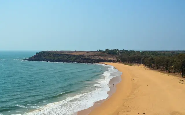
The wettest place in India is Mawsynram in Meghalaya's Khasi Hills, with an average of about 11,802 mm of rain a year according to the IMD (1974 to 2022). Sohra (Cherrapunji), about 10 to 15 km away, is a close second at about 11,176 mm (IMD normal, 1991 to 2020). In the south, Agumbe in Karnataka averages about 7,482 mm and Mahabaleshwar in Maharashtra about 5,883 mm, all with most of it falling between June and September.
- 11,802 mm a year makes Mawsynram India's wettest place (IMD, 1974 to 2022).
- 1,003.6 mm in 24 hours fell on Mawsynram on 17 June 2022, its wettest June day on record.
- Sohra (Cherrapunji) is second and drying: a 2021 study found a break in its rainfall after 1973.
- Agumbe (7,482 mm) and Mahabaleshwar (5,883 mm) lead the Western Ghats.
- 38% higher crash risk in rain on average, in 16 years of Texas data.
This list ranks places strictly by long-term average annual rainfall from India Meteorological Department station records, and it sticks to places a rider can actually reach on a public road.
Station averages use different periods, which I state for each, so treat small gaps as noise. A section further down shows why single years can scramble the order. Then the useful part: what 6 to 12 metres of rain a year does to the roads you will ride.
See the data as a table
| Average annual rainfall (mm) | |
|---|---|
| Mawsynram | 11802 |
| Sohra (Cherrapunji) | 11176 |
| Agumbe | 7482 |
| Mahabaleshwar | 5883 |
| Leh (for contrast) | 35 |
Source: IMD station data: Mawsynram 1974-2022 (via PTI), Sohra and Mahabaleshwar 1991-2020 normals, Agumbe 1981-2010 normal; Leh per Wikipedia · Different averaging periods; Leh rounded from 34.8 mm.
| Rank | Place | Average annual rain (mm) | Period | Wettest month (mm) | Altitude |
|---|---|---|---|---|---|
| 1 | Mawsynram, Meghalaya | 11,802 | 1974 to 2022 | July, about 3,300 (1950 to 2000) | about 1,400 m |
| 2 | Sohra (Cherrapunji), Meghalaya | 11,176 | 1991 to 2020 | July, 2,665 | 1,430 m |
| 3 | Agumbe, Karnataka | 7,482 | 1981 to 2010 | July, 2,432 | 660 m |
| 4 | Mahabaleshwar, Maharashtra | 5,883 | 1991 to 2020 | July, 2,197 | 1,353 m |
1. Mawsynram, Meghalaya
Mawsynram is the wettest inhabited place in India, averaging 11,802.4 mm a year over 1974 to 2022 according to IMD Guwahati. It sits at about 1,400 m on the southern edge of the Khasi Hills, about 69 km from Shillong.
Here monsoon winds loaded with moisture from the Bay of Bengal slam into the first high ground after the Bangladesh plains. The air is forced up, cools, and drops its water: meteorologists call it orographic rain.
In the first days of June 1850, the botanist Joseph Dalton Hooker and his colleague Thomas Thomson came up from Pundua on the Sylhet plains, by elephant to the foot of the hills and then by mule and pony, to Churra, today's Sohra. They stayed in the Khasi Hills for seven months, and Hooker set out his own rain gauges.
In his Himalayan Journals (1854) he wrote that he and Thomson recorded thirty inches in one day and night, about 760 mm, and upwards of 500 inches during their stay. Gauges he moved just half a mile from the station caught widely different amounts. The deluge, he noted, could raise the little streams around Churra fourteen feet in as many hours. For a rider here, the danger is less the rain on the visor than the water across the road.
J. D. Hooker: Himalayan Journals (1854), chapter XXVIII, Project GutenbergMawsynram's 1,003 mm on 17 June 2022 beat the old June record of 944.7 mm from 7 June 1966. Guinness lists 26,000 mm for the calendar year 1985.
Its long-term July average is about 3,300 mm, while December gets about 4 mm, so the dry season here is genuinely dry.
- Average: 11,802 mm a year
- Wettest months: July, June, August
- Ride from: Shillong, about 69 km
2. Sohra (Cherrapunji), Meghalaya
Sohra averages about 11,176 mm a year on the IMD's 1991 to 2020 normal, and 11,359.4 mm over 1971 to 2020, which puts it a few hundred millimetres behind Mawsynram.
It holds two world records:
- a single year: 26,461 mm, between 1 August 1860 and 31 July 1861;
- a single month: 9,300 mm, in July 1861.
It sits at 1,430 m with a mild, subtropical highland climate: the annual mean temperature is about 17.3°C.
- Average: 11,176 mm (1991 to 2020)
- Record year: 26,461 mm (1860 to 1861)
- July average: 2,665 mm

Is Cherrapunji getting drier?
Yes, the long-term record shows a decline at Cherrapunji, and the wettest spot has shifted to Mawsynram. The study below used 119 years of IMD rain-gauge data across northeast India and found a significant break around 1973.
The 2025 season
Recent seasons fit the pattern. In 2025 Meghalaya's southwest monsoon came in 43% below normal, and by 20 August Sohra had about 3,500 mm, roughly half its usual amount, raising talk of its leanest monsoon on record (the record low is 5,401 mm in 1962).
| Station, 2025 | What it recorded | Note |
|---|---|---|
| Sohra (Cherrapunji) | About 3,500 mm by 20 August | Roughly half its usual amount |
| Tamhini, Maharashtra | 5,788 mm in June and July | Highest in India for those two months |
| Surlabbi, Kodagu | Near 7,300 mm by 18 August | Station data compiled by weather watchers |
The Tamhini and Surlabbi figures come from station data compiled by weather watchers and reported by Down To Earth.
The team analysed 119 years of rainfall from 16 IMD rain-gauge stations in northeast India, with Mawsynram data from annual reports, using linear trends with Mann-Kendall significance tests and multiple regression against climate indices (ENSO, Indian Ocean Dipole, Arabian Sea temperature and moisture) and vegetation data from ESA and MODIS. They found a significant change in the rainfall pattern after 1973 and a declining trend at Cherrapunji, with average annual rain over 1989 to 2010 of about 12,550 mm at Mawsynram and 11,963 mm at Cherrapunji. Indian Ocean warming and a visible loss of vegetation in the past two decades were linked to the change. Limit: sparse long-term gauges in the hills, and regression links rather than proof of cause.
Read the paper (free)3. Agumbe, Karnataka
Agumbe, at 660 m in the Malnad of Shivamogga district, averages about 7,482 mm a year on the IMD's 1981 to 2010 normal, and it was long called the Cherrapunji of the South. Its record month is 4,508 mm in August 1946.
The title is now contested. In 2021 and 2022, Hulikal, Nadpal and Mudradi gauges recorded more than Agumbe, and by mid-September 2023 the Karnataka disaster monitoring network had:
- Hulikal at 6,422.9 mm;
- Nadpal at 6,391.8 mm;
- Agumbe at 6,251.5 mm.
For riders, Agumbe means the ghat road through dense rainforest towards Udupi district and the coast.
- Average: 7,482 mm (1981 to 2010)
- Record month: 4,508 mm, August 1946
- Ride: Agumbe ghat to Udupi and the coast

4. Mahabaleshwar, Maharashtra
Mahabaleshwar, at about 1,353 m on the Sahyadri crest in Satara district, averages 5,882.6 mm a year on the IMD's 1991 to 2020 normal, with July alone bringing 2,197 mm.
It is the wettest of the big Maharashtra hill stations and sits above the Konkan, so its approach roads, including SH-72 climbing from Poladpur on the Konkan side, take the full force of the monsoon. Rockfall studies on Western Ghats ghats, like the one on the Bhor Ghat, show how much worse slope stability gets in the rains.
- Average: 5,883 mm (1991 to 2020)
- July average: 2,197 mm
- Konkan approach: SH-72 from Poladpur
What about Amboli and the other Konkan ghats?
Amboli, at about 700 m above Sawantwadi on the Belagavi-Goa side, is famous for monsoon mist and waterfalls, but I could not find a published IMD long-term normal for it, so it stays off the ranking.
The same is true of many Western Ghats spots that top single-season charts, such as Tamhini, Surlabbi and Hulikal: they are gauges with spectacular recent totals but no published 30-year averages.
For the coastal route below them, read the Konkan coastal highway guide for the coastal route below them.


What does that much rain do to a motorcycle ride?
Heavy rain raises crash risk sharply, even for car drivers, and riders feel it first through lost grip, lost visibility and longer stopping distances. The best large recent study comes from Texas, where good weather-radar data can be matched to every crash.
The authors matched 16 years of Texas crash records with precipitation data to compare crash rates in rain with comparable dry conditions. Precipitation raised crash risk in every year by at least 32%, by 38% on average, and by 36 to 52% depending on intensity, with the biggest increases above 25 mm per hour. Rain crashes were less severe on average, and risk was highest in early-morning hours and among drivers aged 18 to 30. Limit: mostly car traffic in a US state, with a different road mix from India; but monsoon cloudbursts in the Khasi Hills and Western Ghats regularly exceed the 25 mm per hour band that showed the largest effect.
Read the paper (free)In the wettest belts of India, three hazards come on top of the general wet-road risk:
- Fog and cloud on the ghat. At 1,350 to 1,430 m, Mahabaleshwar and Sohra are high enough to be in cloud during the monsoon. When visibility drops, a lit headlight and bright rain gear matter more than a fast lap time.
- Washed-out shoulders and landslides. Water running off the hill strips gravel onto the road and undercuts the outer edge. Ride the centre of your lane and keep off the soft shoulder.
- Algae and moss. Rainforest ghats like Agumbe stay damp under the canopy; painted lines, manhole covers and shaded hairpins are the slipperiest surfaces.
Rain also beats gear. On my Chikmagalur trip, rain and fog hit on day two, and I have found my Rynox waterproof socks underwhelming in the wet.
Plan for layers that dry, not for staying perfectly dry. Twelve metres of rain a year will find its way in.
Monsoon timing by region is in the monsoon onset dates post, and the Northeast loop that passes Shillong and Sohra is in the solo Northeast route.
What's new
- IMD report: 2025 was Meghalaya's warmest year since 1901, monsoon 43% short The Week (PTI), Nov 2026
- Cherrapunji heads for a record-dry monsoon as Surlabbi and Tamhini top the charts Down To Earth, Aug 2025
- New study: rain raises crash risk by 38% on average over 16 years of Texas data Scientific Reports, 2025
For the full Ride Atlas, see Yatri.
Questions people ask
Which is the wettest place in India?
Mawsynram in Meghalaya, averaging about 11,802 mm a year over 1974 to 2022 per the IMD. Sohra (Cherrapunji), about 10 to 15 km away, is second with about 11,176 mm on the 1991 to 2020 normal.
Is Cherrapunji still the wettest place on Earth?
No. A 2021 study of 119 years of data found Cherrapunji's rainfall declining after 1973 and the wettest spot shifting to Mawsynram. Some Colombian stations also report higher long-term averages, around 12,700 to 12,900 mm.
Which is the wettest place in South India?
Agumbe in Karnataka has the best-known long-term record, about 7,482 mm a year. In recent seasons Hulikal and gauges in Udupi district have recorded more in individual years.
Is it safe to ride to Meghalaya or the Western Ghats in the monsoon?
It is possible, and the scenery is at its best, but crash risk rises in rain and ghats close for landslides. Ride in daylight, use bright gear and a lit headlight, check IMD district warnings each morning, and build spare days into the plan.
Sources
- ThePrint (PTI): Mawsynram gets record 1003.6 mm on a June day, IMD averages (2022)
- Wikipedia: Mawsynram (IMD monthly averages, records) (accessed 2026)
- Wikipedia: Cherrapunji (IMD 1991-2020 normals, records) (accessed 2026)
- Wikipedia: Agumbe (IMD 1981-2010 normals) (accessed 2026)
- Wikipedia: Mahabaleshwar (IMD 1991-2020 normals) (accessed 2026)
- Wikipedia: Amboli (accessed 2026)
- Wikipedia: Leh (annual rainfall) (accessed 2026)
- Down To Earth: Queen of rain no more, Agumbe and the Udupi towns (KSNDMC data) (2023)
- Down To Earth: Cherrapunji on way to driest monsoon on record (2025)
- The Week (PTI): 2025 warmest year in Meghalaya since 1901, IMD report (2026)
- Kuttippurath et al.: Observed rainfall changes 1901-2019 over the wettest place on Earth, ERL (2021)
- Tafazzol et al.: Relative crash risk during rainfall in Texas 2006-2021, Scientific Reports (2025)
- Hooker JD: Himalayan Journals, Project Gutenberg (1854; Churra rainfall in 1850, streams rising fourteen feet; source for the story)

Sapta (Saptarshi Sarkar) is a mechanical engineer turned marketer in Bengaluru and a solo touring rider. He writes the seven Saptaverse blogs. Work with him or read more of RoadHook Rides.